
Tyrol
391 known cemeteries in Tyrol, Austria.
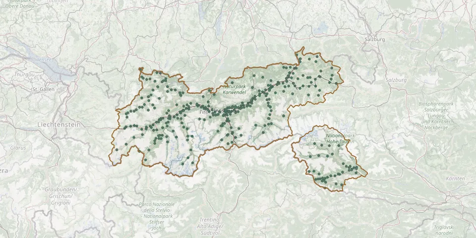 © OpenStreetMap
- Untertilliach Churchyard, Former CemeteryGPS coordinates: 46.70386° N, 12.67845° E
- Vils New CemeteryGPS coordinates: 47.54896° N, 10.63199° E
- Virgen CemeteryGPS coordinates: 47.00346° N, 12.45748° E
- Volders CemeteryGPS coordinates: 47.28529° N, 11.56889° E
- Volders War CemeteryGPS coordinates: 47.28008° N, 11.55349° E
- Völs Plague CemeteryGPS coordinates: 47.25430° N, 11.32555° E
- Vomp CemeteryGPS coordinates: 47.34080° N, 11.68265° E
- Vomperbach CemeteryGPS coordinates: 47.32637° N, 11.66942° E
- Vomp New CemeteryGPS coordinates: 47.33797° N, 11.68382° E
- Vorderhornbach New CemeteryGPS coordinates: 47.36904° N, 10.53628° E
- Waidring New Cemetery with Funeral HallGPS coordinates: 47.58373° N, 12.56902° E
- Waidring Old CemeteryGPS coordinates: 47.58361° N, 12.56845° E
- Walchsee CemeteryGPS coordinates: 47.65027° N, 12.31849° E
- Wald Cemetery with ChapelGPS coordinates: 46.96789° N, 11.00728° E
- Wald der EwigkeitGPS coordinates: 47.47112° N, 12.02802° E
- Wattens CemeteryGPS coordinates: 47.28917° N, 11.59629° E
- Weer CemeteryGPS coordinates: 47.30587° N, 11.64529° E
- Weißenbach CemeteryGPS coordinates: 47.44381° N, 10.63916° E
- Weißenbach Old CemeteryGPS coordinates: 47.44239° N, 10.64161° E
- Wenns CemeteryGPS coordinates: 47.17061° N, 10.73274° E
- Wildermieming CemeteryGPS coordinates: 47.31880° N, 11.00658° E
- Wörgl South CemeteryGPS coordinates: 47.48367° N, 12.07005° E
- Wörgl Woodland CemeteryGPS coordinates: 47.48432° N, 12.06850° E
- Zams Burial Ground for Prisoners of War and Forced LabourersGPS coordinates: 47.15766° N, 10.58770° E
- Zams CemeteryGPS coordinates: 47.15740° N, 10.58833° E
- Zell am Ziller CemeteryGPS coordinates: 47.23394° N, 11.88193° E
- Zell CemeteryGPS coordinates: 47.58086° N, 12.15521° E
- Zellerberg CemeteryGPS coordinates: 47.58104° N, 12.15513° E
- Zell New CemeteryGPS coordinates: 47.23449° N, 11.88250° E
- Zirl CemeteryGPS coordinates: 47.27128° N, 11.24275° E