
Tyrol
391 known cemeteries in Tyrol, Austria.
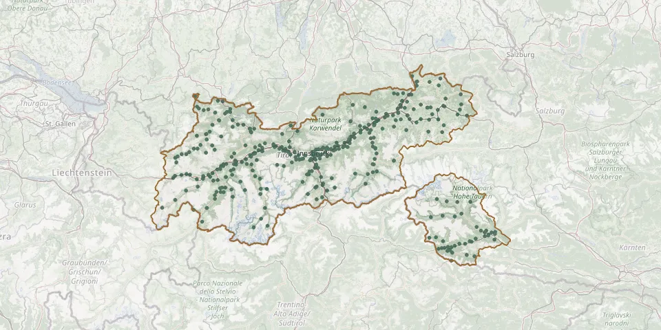 © OpenStreetMap
- Hopfgarten CemeteryGPS coordinates: 47.45042° N, 12.15966° E
- Hopfgarten in Defereggen CemeteryGPS coordinates: 46.92147° N, 12.52109° E
- Höttinger CemeteryGPS coordinates: 47.27239° N, 11.38665° E
- Hötting Old CemeteryGPS coordinates: 47.27250° N, 11.38410° E
- Hötting Plague CemeteryGPS coordinates: 47.27316° N, 11.38868° E
- Huben CemeteryGPS coordinates: 47.04340° N, 10.96979° E
- Huben CemeteryGPS coordinates: 46.93637° N, 12.57390° E
- Hüttenbichl War CemeteryGPS coordinates: 47.50538° N, 10.72918° E
- Igls CemeteryGPS coordinates: 47.23295° N, 11.40586° E
- Imsterberg CemeteryGPS coordinates: 47.20709° N, 10.69762° E
- Innervillgraten CemeteryGPS coordinates: 46.80818° N, 12.36975° E
- Innsbruck ChurchyardGPS coordinates: 47.23598° N, 11.40244° E
- Innsbruck Convent CemeteryGPS coordinates: 47.25281° N, 11.40046° E
- Innsbruck Former Plague CemeteryGPS coordinates: 47.26816° N, 11.48532° E
- Innsbruck Jewish CemeteryGPS coordinates: 47.25738° N, 11.38551° E
- Innsbruck Old Military CemeteryGPS coordinates: 47.26137° N, 11.40949° E
- Innsbruck West CemeteryGPS coordinates: 47.25916° N, 11.38586° E
- Innsbruck Woodland CemeteryGPS coordinates: 47.22661° N, 11.36505° E
- Inzing New CemeteryGPS coordinates: 47.27400° N, 11.18842° E
- Ischgl CemeteryGPS coordinates: 47.01157° N, 10.29112° E
- Iselsberg CemeteryGPS coordinates: 46.83748° N, 12.84320° E
- Itter New CemeteryGPS coordinates: 47.47043° N, 12.14182° E
- Itter Old CemeteryGPS coordinates: 47.47022° N, 12.14276° E
- Jenbach Old CemeteryGPS coordinates: 47.39114° N, 11.77078° E
- Jerzens ChurchyardGPS coordinates: 47.14909° N, 10.74550° E
- Jochberg CemeteryGPS coordinates: 47.38016° N, 12.41967° E
- Jungholz CemeteryGPS coordinates: 47.57371° N, 10.44778° E
- Kaisers CemeteryGPS coordinates: 47.21555° N, 10.29973° E
- Kalkstein CemeteryGPS coordinates: 46.80498° N, 12.31821° E
- Kals am GroßglocknerGPS coordinates: 47.00128° N, 12.64460° E