
Tyrol
391 known cemeteries in Tyrol, Austria.
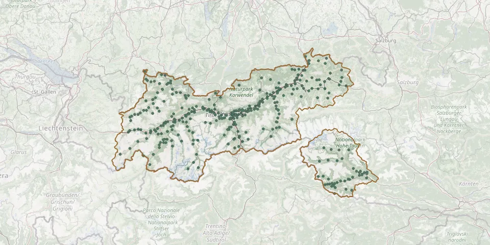 © OpenStreetMap
- Pfarrkirche St. Jodok am BrennerGPS coordinates: 47.06264° N, 11.50108° E
- Pfarrkirche ThaurGPS coordinates: 47.29452° N, 11.47159° E
- Pfarrkirche VorderthierseeGPS coordinates: 47.59043° N, 12.10880° E
- Pfarrkirche Westendorf (Tirol)GPS coordinates: 47.43180° N, 12.21490° E
- Pfarrkirche WiesingGPS coordinates: 47.40524° N, 11.79843° E
- Pfunds New CemeteryGPS coordinates: 46.96780° N, 10.54272° E
- Pfunds Old CemeteryGPS coordinates: 46.96782° N, 10.54158° E
- Pians CemeteryGPS coordinates: 47.13525° N, 10.51397° E
- Pill CemeteryGPS coordinates: 47.32035° N, 11.68128° E
- Piller New CemeteryGPS coordinates: 47.13643° N, 10.69522° E
- Piller Old CemeteryGPS coordinates: 47.13560° N, 10.69405° E
- Pinswang CemeteryGPS coordinates: 47.54617° N, 10.66885° E
- Polling in Tirol CemeteryGPS coordinates: 47.28084° N, 11.15173° E
- Prägraten CemeteryGPS coordinates: 47.01642° N, 12.37775° E
- Prutz CemeteryGPS coordinates: 47.07870° N, 10.66411° E
- Radfeld CemeteryGPS coordinates: 47.44585° N, 11.91148° E
- Ramsau im Zillertal CemeteryGPS coordinates: 47.20512° N, 11.87467° E
- Rattenberg CemeteryGPS coordinates: 47.43901° N, 11.89785° E
- Reith bei Kitzbühel CemeteryGPS coordinates: 47.47592° N, 12.34160° E
- Reith bei Seefeld CemeteryGPS coordinates: 47.29822° N, 11.20460° E
- Reith im Alpbachtal CemeteryGPS coordinates: 47.41689° N, 11.87793° E
- Reith im Alpbachtal ChurchyardGPS coordinates: 47.41654° N, 11.87709° E
- Reith Plague CemeteryGPS coordinates: 47.42286° N, 11.88046° E
- Rettenbach CemeteryGPS coordinates: 46.96777° N, 11.00737° E
- Reutte CemeteryGPS coordinates: 47.49071° N, 10.72301° E
- Ried CemeteryGPS coordinates: 47.05471° N, 10.65354° E
- Rinn CemeteryGPS coordinates: 47.24942° N, 11.50192° E
- Roppen CemeteryGPS coordinates: 47.21783° N, 10.82149° E
- Rum CemeteryGPS coordinates: 47.28848° N, 11.45993° E
- Rum Parish Church CemeteryGPS coordinates: 47.28684° N, 11.46029° E