
Grodno Region
201 known cemeteries in Grodno Region, Belarus.
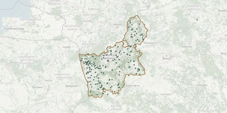 © OpenStreetMap
- Halynka Catholic CemeteryGPS coordinates: 53.77110° N, 23.56610° E
- Halynka CemeteryGPS coordinates: 53.18123° N, 23.91313° E
- Harbachy CemeteryGPS coordinates: 53.10990° N, 24.04881° E
- Harnastaevichy CemeteryGPS coordinates: 52.97959° N, 24.39764° E
- Hezgaly CemeteryGPS coordinates: 53.60193° N, 25.36884° E
- Hiry CemeteryGPS coordinates: 54.63276° N, 26.19646° E
- Hniezna CemeteryGPS coordinates: 53.12497° N, 24.34003° E
- Holni CemeteryGPS coordinates: 53.29803° N, 24.01598° E
- Horny CemeteryGPS coordinates: 53.56376° N, 24.00597° E
- Hozha CemeteryGPS coordinates: 53.81923° N, 23.85957° E
- Hradaushchyzna Parish CemeteryGPS coordinates: 54.68170° N, 25.80934° E
- Hrandzichy-23 CemeteryGPS coordinates: 53.72545° N, 23.89940° E
- Hrandzichy-23 CemeteryGPS coordinates: 53.73056° N, 23.89527° E
- Hrodna Malyshchyna CemeteryGPS coordinates: 53.70726° N, 23.86797° E
- Hrodna Old Catholic Parish CemeteryGPS coordinates: 53.66861° N, 23.84381° E
- Hrodna Old Orthodox CemeteryGPS coordinates: 53.67060° N, 23.84202° E
- Hrodna Polish Soldiers' CemeteryGPS coordinates: 53.66944° N, 23.84839° E
- Hrodna Zabalats CemeteryGPS coordinates: 53.71161° N, 23.87882° E
- Indura CemeteryGPS coordinates: 53.45473° N, 23.89852° E
- Iwye CemeteryGPS coordinates: 53.93961° N, 25.75774° E
- Izabelin CemeteryGPS coordinates: 53.09342° N, 24.54639° E
- Kalantai CemeteryGPS coordinates: 53.20130° N, 24.40957° E
- Kamyanka CemeteryGPS coordinates: 53.55837° N, 24.51340° E
- Kanyukhi Abandoned Orthodox CemeteryGPS coordinates: 52.99078° N, 24.65432° E
- Kanyukhi Orthodox CemeteryGPS coordinates: 53.00475° N, 24.64704° E
- Kaptsyowka North CemeteryGPS coordinates: 53.56622° N, 23.87023° E
- Kaptsyowka South CemeteryGPS coordinates: 53.56466° N, 23.86813° E
- Kashubintsy Parish CemeteryGPS coordinates: 53.61857° N, 24.21337° E
- Kazlovichy CemeteryGPS coordinates: 53.67966° N, 24.03349° E
- Kemelishki CemeteryGPS coordinates: 54.85364° N, 25.87933° E