
Cochabamba
80 known cemeteries in Cochabamba, Bolivia.
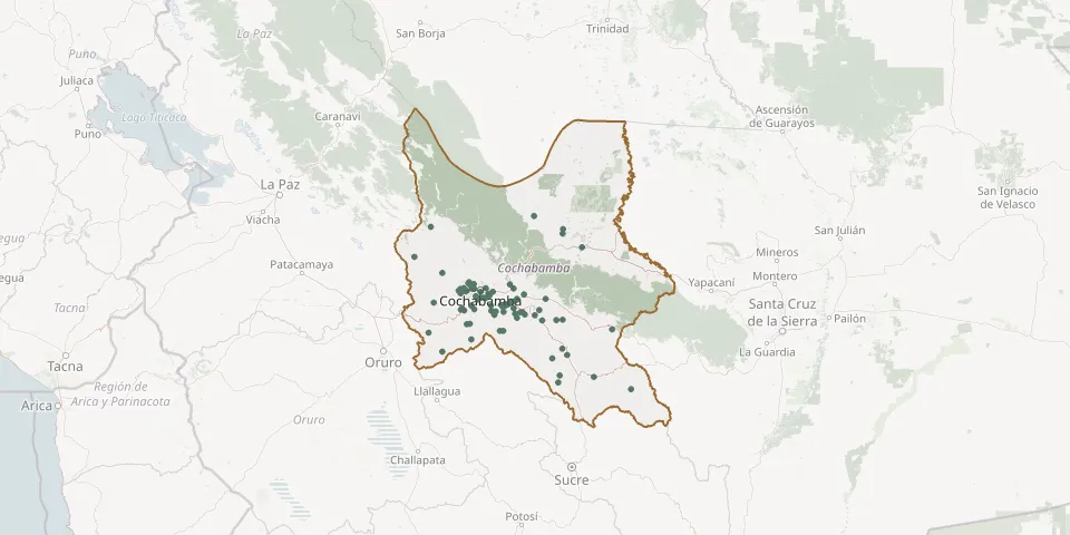 © OpenStreetMap
- Aguada General CemeteryGPS coordinates: 18.00483° S, 65.30738° W
- Aguirre General CemeteryGPS coordinates: 17.37918° S, 65.83293° W
- Anocaraire CemeteryGPS coordinates: 17.37514° S, 66.32495° W
- Anzaldo CemeteryGPS coordinates: 17.77760° S, 65.93652° W
- Apillapampa CemeteryGPS coordinates: 17.85784° S, 66.25170° W
- Arbieto CemeteryGPS coordinates: 17.59344° S, 66.01586° W
- Bella Vista CemeteryGPS coordinates: 17.33010° S, 66.28118° W
- Bolívar CemeteryGPS coordinates: 17.97317° S, 66.53515° W
- Capinota General CemeteryGPS coordinates: 17.71204° S, 66.26669° W
- Carcaje Central CemeteryGPS coordinates: 17.54036° S, 66.05664° W
- Chimoré CemeteryGPS coordinates: 16.99059° S, 65.15853° W
- Chullpa Orkho CemeteryGPS coordinates: 17.60211° S, 65.76811° W
- Churigala CemeteryGPS coordinates: 17.57554° S, 66.22210° W
- Cliza CemeteryGPS coordinates: 17.60028° S, 65.93139° W
- Cochabamba Croatian CemeteryGPS coordinates: 17.40904° S, 66.15938° W
- Cochabamba General CemeteryGPS coordinates: 17.40935° S, 66.16055° W
- Colcapirhua General CemeteryGPS coordinates: 17.38111° S, 66.23861° W
- Colomi General CemeteryGPS coordinates: 17.34062° S, 65.86905° W
- Coparancho CemeteryGPS coordinates: 17.67357° S, 65.34950° W
- Cuchumuela General CemeteryGPS coordinates: 17.65432° S, 65.79939° W
- El Abra CemeteryGPS coordinates: 17.42873° S, 66.08411° W
- El Choro CemeteryGPS coordinates: 16.79692° S, 66.64955° W
- El Paso CemeteryGPS coordinates: 17.34432° S, 66.26520° W
- Hilury CemeteryGPS coordinates: 17.47788° S, 65.79949° W
- Independencia CemeteryGPS coordinates: 17.08059° S, 66.81333° W
- Irpa Irpa General CemeteryGPS coordinates: 17.71319° S, 66.29389° W
- Itapaya General CemeteryGPS coordinates: 17.58642° S, 66.32232° W
- K'ara K'ara General CemeteryGPS coordinates: 17.46701° S, 66.12569° W
- Kayarani CemeteryGPS coordinates: 17.47722° S, 65.51854° W
- La ConcordiaGPS coordinates: 17.38069° S, 66.22221° W