
Oruro
28 known cemeteries in Oruro, Bolivia.
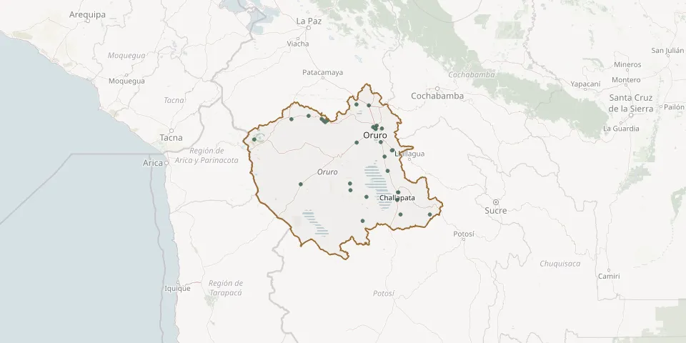 © OpenStreetMap
- Amachuma CemeteryGPS coordinates: 17.62408° S, 67.40317° W
- Andamarca CemeteryGPS coordinates: 18.77729° S, 67.50298° W
- Aroma General CemeteryGPS coordinates: 19.32141° S, 67.30846° W
- Avaroa CemeteryGPS coordinates: 18.87667° S, 67.49753° W
- Caracollo General CemeteryGPS coordinates: 17.63617° S, 67.21338° W
- Challapata General CemeteryGPS coordinates: 18.90660° S, 66.76188° W
- Chapicollo CemeteryGPS coordinates: 17.93487° S, 67.09510° W
- Curahuara de Carangas CemeteryGPS coordinates: 17.83895° S, 68.40372° W
- Huachacalla CemeteryGPS coordinates: 18.78949° S, 68.26167° W
- Huanuni General CemeteryGPS coordinates: 18.29053° S, 66.84631° W
- Huayllamarca CemeteryGPS coordinates: 17.83585° S, 67.94034° W
- Iroco CemeteryGPS coordinates: 17.95445° S, 67.14867° W
- Jaruma CemeteryGPS coordinates: 17.85746° S, 67.85257° W
- Lagunillas CemeteryGPS coordinates: 19.22832° S, 66.27566° W
- Machacamarca General CemeteryGPS coordinates: 18.17239° S, 67.03010° W
- Orinoca CemeteryGPS coordinates: 18.97062° S, 67.25280° W
- Oruro General CemeteryGPS coordinates: 17.98116° S, 67.10956° W
- Pazña CemeteryGPS coordinates: 18.59586° S, 66.92490° W
- Pocoroco CemeteryGPS coordinates: 17.88139° S, 67.88354° W
- Poopó CemeteryGPS coordinates: 18.38702° S, 66.97144° W
- Romero Huma CemeteryGPS coordinates: 17.86525° S, 67.90767° W
- Sajama General CemeteryGPS coordinates: 18.13626° S, 68.97529° W
- San Pedro de Totora CemeteryGPS coordinates: 17.79115° S, 68.14031° W
- Santiago de Huari General CemeteryGPS coordinates: 19.01539° S, 66.77878° W
- Sepulturas General CemeteryGPS coordinates: 17.97372° S, 67.01312° W
- Toledo CemeteryGPS coordinates: 18.18001° S, 67.40062° W
- Urmiri de Quillacas CemeteryGPS coordinates: 19.22659° S, 66.72579° W
- Venta y Media General CemeteryGPS coordinates: 18.29640° S, 66.86075° W