
Tarija
30 known cemeteries in Tarija, Bolivia.
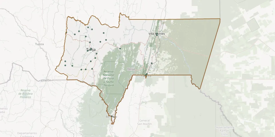 © OpenStreetMap
- Alto de España CemeteryGPS coordinates: 21.36889° S, 64.44598° W
- Bermejo General CemeteryGPS coordinates: 22.72931° S, 64.33447° W
- Camacho CemeteryGPS coordinates: 21.90060° S, 64.91981° W
- Cañas CemeteryGPS coordinates: 21.89715° S, 64.83509° W
- Chocloca CemeteryGPS coordinates: 21.75246° S, 64.73867° W
- Copacabana CemeteryGPS coordinates: 21.83245° S, 65.09246° W
- Divina Paz Cemetery (San Geronimo)GPS coordinates: 21.99327° S, 63.68208° W
- El Puente General CemeteryGPS coordinates: 21.23657° S, 65.20762° W
- Entre Ríos General CemeteryGPS coordinates: 21.52704° S, 64.17676° W
- Habra yugos CemeteryGPS coordinates: 21.24461° S, 64.49076° W
- León Cancha CemeteryGPS coordinates: 21.18055° S, 64.71543° W
- Padcaya General CemeteryGPS coordinates: 21.88625° S, 64.71343° W
- Paicho Chilcas CemeteryGPS coordinates: 21.21434° S, 64.96348° W
- San Antonio CemeteryGPS coordinates: 21.28445° S, 63.47191° W
- San Isidro CemeteryGPS coordinates: 21.97848° S, 63.66374° W
- San Lorenzo CemeteryGPS coordinates: 21.41283° S, 64.75256° W
- Santa Ana la Vieja CemeteryGPS coordinates: 21.61483° S, 64.62674° W
- Tarija Garden CemeteryGPS coordinates: 21.54528° S, 64.73662° W
- Tarija General CemeteryGPS coordinates: 21.52500° S, 64.73333° W
- Tomayapo CemeteryGPS coordinates: 21.27061° S, 65.04543° W
- Trancas CemeteryGPS coordinates: 21.30838° S, 64.83452° W
- Turumayo CemeteryGPS coordinates: 21.56483° S, 64.79882° W
- Uriondo CemeteryGPS coordinates: 21.69333° S, 64.65361° W
- Villa El Carmen CemeteryGPS coordinates: 21.78651° S, 63.56996° W
- Villa Montes General CemeteryGPS coordinates: 21.25417° S, 63.46917° W
- Yacuíba General CemeteryGPS coordinates: 22.01139° S, 63.67914° W
- Yesera CemeteryGPS coordinates: 21.40356° S, 64.55538° W
- Yumasa CemeteryGPS coordinates: 21.14369° S, 64.78932° W
- Yunchará CemeteryGPS coordinates: 21.82531° S, 65.22755° W
- Zurita CemeteryGPS coordinates: 21.75306° S, 65.22841° W