
Espírito Santo
725 known cemeteries in Espírito Santo, Brazil.
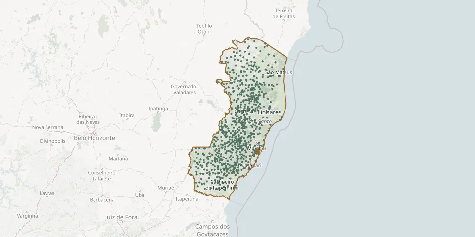 © OpenStreetMap
- Acioli Municipal CemeteryGPS coordinates: 19.65688° S, 40.46312° W
- Água Boa CemeteryGPS coordinates: 17.98175° S, 40.39521° W
- Água Doce do Norte Municipal CemeteryGPS coordinates: 18.54895° S, 40.97677° W
- Água Limpa CemeteryGPS coordinates: 18.93366° S, 39.97429° W
- Água Limpa Community CemeteryGPS coordinates: 18.86896° S, 40.67042° W
- Águia Branca Polish CemeteryGPS coordinates: 18.97924° S, 40.74079° W
- Airituba CemeteryGPS coordinates: 20.94822° S, 41.68950° W
- Alegre Neighbourhood Municipal Cemetery, SooretamaGPS coordinates: 19.19971° S, 40.09447° W
- Alfredo Chaves CemeteryGPS coordinates: 20.63713° S, 40.75055° W
- Alto Barra Encoberta Lutheran CemeteryGPS coordinates: 20.04859° S, 40.94465° W
- Alto Bérgamo Municipal CemeteryGPS coordinates: 19.76348° S, 40.46377° W
- Alto Biriricas CemeteryGPS coordinates: 20.27642° S, 40.59905° W
- Alto Calçado CemeteryGPS coordinates: 20.94502° S, 41.61800° W
- Alto Caldeirão CemeteryGPS coordinates: 19.95707° S, 40.74314° W
- Alto Caxixe Municipal CemeteryGPS coordinates: 20.41881° S, 41.08328° W
- Alto Galo Community CemeteryGPS coordinates: 20.24277° S, 40.64559° W
- Alto Jatiboca Lutheran CemeteryGPS coordinates: 19.99962° S, 40.89214° W
- Alto Jatibocas CemeteryGPS coordinates: 20.00332° S, 40.88896° W
- Alto Jequitibá CemeteryGPS coordinates: 20.14285° S, 40.72694° W
- Alto Joéba CemeteryGPS coordinates: 20.69509° S, 40.79881° W
- Alto Jucu Lutheran Churchyard, Domingos MartinsGPS coordinates: 20.28833° S, 41.00793° W
- Alto Liberdade CemeteryGPS coordinates: 19.36793° S, 40.53971° W
- Alto Luxemburgo Community CemeteryGPS coordinates: 20.17319° S, 40.59663° W
- Alto Moacir CemeteryGPS coordinates: 19.29096° S, 40.50770° W
- Alto Muniz CemeteryGPS coordinates: 18.89879° S, 40.65564° W
- Alto Mutum CemeteryGPS coordinates: 19.27475° S, 40.90800° W
- Alto Pancas CemeteryGPS coordinates: 19.10622° S, 40.92727° W
- Alto Pongal CemeteryGPS coordinates: 20.72198° S, 40.78240° W
- Alto Possmouser Lutheran CemeteryGPS coordinates: 20.06791° S, 40.83572° W
- Alto Rio das Pedras Lutheran CemeteryGPS coordinates: 20.17794° S, 40.67229° W