
Rio Grande do Sul
2,186 known cemeteries in Rio Grande do Sul, Brazil.
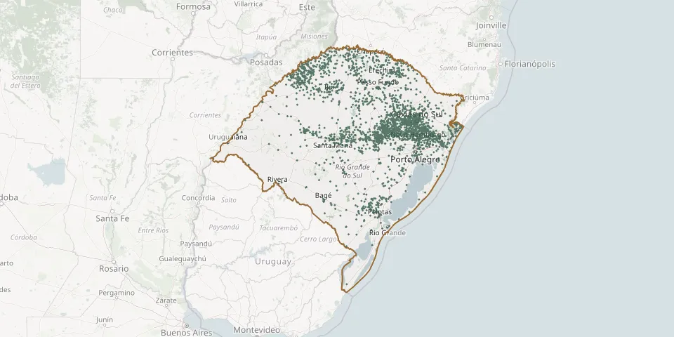 © OpenStreetMap
- Alto Boa Vista New Evangelical CemeteryGPS coordinates: 29.55858° S, 52.45434° W
- Alto Boa Vista Old Evangelical CemeteryGPS coordinates: 29.56067° S, 52.45620° W
- Alto Caraá CemeteryGPS coordinates: 29.83416° S, 50.35719° W
- Alto Conventos CemeteryGPS coordinates: 29.42212° S, 52.10795° W
- Alto das Videiras CemeteryGPS coordinates: 29.21596° S, 51.56357° W
- Alto da União CemeteryGPS coordinates: 28.45332° S, 53.85906° W
- Alto Erval Novo CemeteryGPS coordinates: 27.52656° S, 53.93968° W
- Alto Feliz Lutheran ChurchyardGPS coordinates: 29.37605° S, 51.31385° W
- Alto Formosa Catholic CemeteryGPS coordinates: 29.56002° S, 52.63923° W
- Alto Linha Nova CemeteryGPS coordinates: 29.55871° S, 52.39764° W
- Alto Linha Santa Cruz New Evangelical CemeteryGPS coordinates: 29.63573° S, 52.41371° W
- Alto Mascarada Cemetery (Rolante)GPS coordinates: 29.57974° S, 50.47418° W
- Alto Paredão CemeteryGPS coordinates: 29.40071° S, 52.40644° W
- Alto Passa Sete CemeteryGPS coordinates: 29.55371° S, 52.81473° W
- Alto Recreio CemeteryGPS coordinates: 27.67713° S, 52.83984° W
- Alto Rolante IECLB CemeteryGPS coordinates: 29.63951° S, 50.50241° W
- Alto Rolante Lutheran CemeteryGPS coordinates: 29.64242° S, 50.50894° W
- Amaral Ferrador CemeteryGPS coordinates: 30.87757° S, 52.25823° W
- Amaral Ferrador CemeteryGPS coordinates: 30.74159° S, 52.40736° W
- Amaral Ribeiro CemeteryGPS coordinates: 29.63389° S, 50.97264° W
- Ametista do Sul CemeteryGPS coordinates: 27.37094° S, 53.17362° W
- Ana Rech Cemetery (new)GPS coordinates: 29.09585° S, 51.08352° W
- André da Rocha Public Municipal CemeteryGPS coordinates: 28.63445° S, 51.57059° W
- André Haubert Road Cemetery, Lomba GrandeGPS coordinates: 29.77192° S, 50.95074° W
- Angels CemeteryGPS coordinates: 31.39544° S, 53.87671° W
- Angels CemeteryGPS coordinates: 29.47802° S, 52.55827° W
- Angels' CemeteryGPS coordinates: 30.93645° S, 53.71046° W
- Anita Garibaldi Community CemeteryGPS coordinates: 27.87597° S, 51.97385° W
- Anjos Cemetery, Sentinela do SulGPS coordinates: 30.53826° S, 51.62082° W
- Anta Gorda Church CemeteryGPS coordinates: 28.98745° S, 51.99361° W