
Sergipe
172 known cemeteries in Sergipe, Brazil.
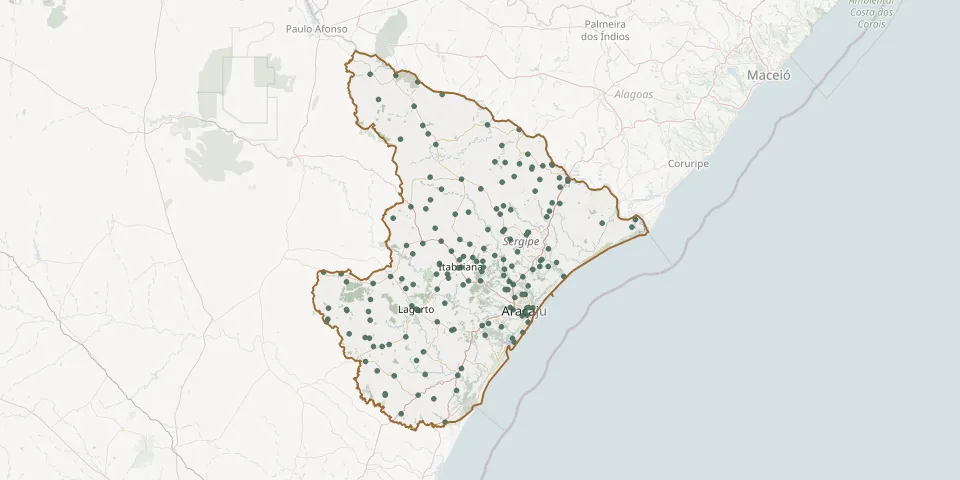 © OpenStreetMap
- São Mateus CemeteryGPS coordinates: 10.11914° S, 37.23973° W
- São Roque Municipal CemeteryGPS coordinates: 10.74641° S, 37.49507° W
- São Sebastião CemeteryGPS coordinates: 10.71531° S, 38.18092° W
- Saquinho Village CemeteryGPS coordinates: 11.11629° S, 37.85880° W
- Senhor do Bomfim Parish CemeteryGPS coordinates: 10.91338° S, 37.67257° W
- Senhor do Bonfim CemeteryGPS coordinates: 10.88178° S, 37.51467° W
- Senhor do Bonfim Municipal CemeteryGPS coordinates: 11.27360° S, 37.79380° W
- Serra do Machado Village CemeteryGPS coordinates: 10.56309° S, 37.37646° W
- Simão Dias Municipal Cemetery, Curral dos BoisGPS coordinates: 10.86238° S, 37.92237° W
- Sítios Novos Community CemeteryGPS coordinates: 9.92216° S, 37.63610° W
- Sucupira CemeteryGPS coordinates: 10.37291° S, 37.23038° W
- Taboca Village Cemetery, Nossa Senhora das DoresGPS coordinates: 10.48355° S, 37.27882° W
- Taiçoca de Fora CemeteryGPS coordinates: 10.83443° S, 37.09009° W
- Tanque Novo Local CemeteryGPS coordinates: 11.10481° S, 37.82069° W
- Telha Municipal CemeteryGPS coordinates: 10.20577° S, 36.88530° W
- Terra Dura Municipal CemeteryGPS coordinates: 10.60164° S, 37.47880° W
- Tomar de Geru Municipal CemeteryGPS coordinates: 11.37080° S, 37.84320° W
- Tomar do Geru Municipal CemeteryGPS coordinates: 11.37689° S, 37.84184° W
- Trindade CemeteryGPS coordinates: 10.50090° S, 37.05540° W
- Triunfo CemeteryGPS coordinates: 10.77551° S, 37.90885° W
- Umbaúba Municipal CemeteryGPS coordinates: 11.37851° S, 37.66124° W
- Visgueira Village CemeteryGPS coordinates: 10.38574° S, 36.94046° W