
British Columbia
252 known cemeteries in British Columbia, Canada.
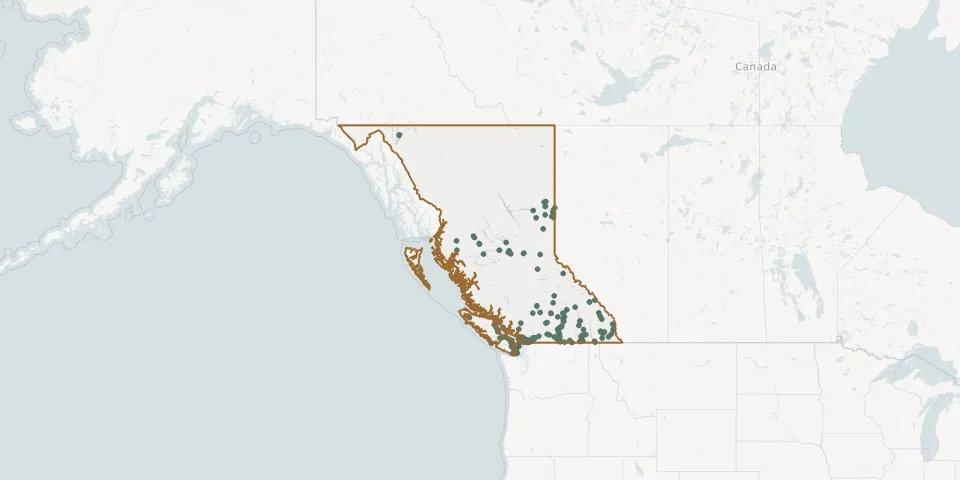 © OpenStreetMap
- Saik'uz CemeteryGPS coordinates: 53.94575° N, 124.10748° W
- Saint Andrew's Anglican CemeteryGPS coordinates: 48.72980° N, 123.67059° W
- Saint Ann's Catholic Church CemeteryGPS coordinates: 48.77965° N, 123.65024° W
- Saint Francis Xavier Catholic Church CemeteryGPS coordinates: 48.66450° N, 123.55759° W
- Saint John The Baptist Anglican Church CemeteryGPS coordinates: 48.67842° N, 123.58925° W
- Saint Luke's Church and CemeteryGPS coordinates: 50.46746° N, 119.74631° W
- Saint Margaret's CemeteryGPS coordinates: 49.49939° N, 115.05476° W
- Saint Mark Anglican CemeteryGPS coordinates: 48.86841° N, 123.52970° W
- Saint Mary's CemeteryGPS coordinates: 49.11083° N, 121.94953° W
- Saint Mary the Virgin Anglican Church CemeteryGPS coordinates: 48.38070° N, 123.53131° W
- Saint Michael and All Angels' Church CemeteryGPS coordinates: 48.50282° N, 123.40438° W
- Saint Paul Catholic Church CemeteryGPS coordinates: 48.77216° N, 123.45863° W
- Saint Peter's Roman Catholic CemeteryGPS coordinates: 49.16291° N, 123.94912° W
- Saint Peter's Roman Catholic CemeteryGPS coordinates: 49.22291° N, 122.90024° W
- Saint Stephen's Anglican CemeteryGPS coordinates: 48.59629° N, 123.45447° W
- Saint Theresa Roman Catholic CemeteryGPS coordinates: 49.91885° N, 119.40890° W
- Sand Creek District CemeteryGPS coordinates: 49.33688° N, 115.29134° W
- Sandwick CemeteryGPS coordinates: 49.70357° N, 124.98999° W
- Saturna Island Community CemeteryGPS coordinates: 48.78980° N, 123.16320° W
- Schara Tzedeck CemeteryGPS coordinates: 49.19929° N, 122.95591° W
- Seabird Island CemeteryGPS coordinates: 49.27991° N, 121.72454° W
- Shady Creek Church CemeteryGPS coordinates: 48.57678° N, 123.40724° W
- Shawnigan Community CemeteryGPS coordinates: 48.64508° N, 123.62538° W
- Shoreacres Doukhobor CemeteryGPS coordinates: 49.43461° N, 117.52306° W
- Shuswap Memorial Cemetery TrailsGPS coordinates: 50.68526° N, 119.25219° W
- Slocan CemeteryGPS coordinates: 49.76080° N, 117.46626° W
- Smithers CemeteryGPS coordinates: 54.77766° N, 127.14938° W
- Songhees First Nations CemeteryGPS coordinates: 48.44300° N, 123.42609° W
- Sooke Harbour CemeteryGPS coordinates: 48.38694° N, 123.69138° W
- Soowahlie First Nation CemeteryGPS coordinates: 49.08678° N, 121.96539° W