
Manitoba
548 known cemeteries in Manitoba, Canada.
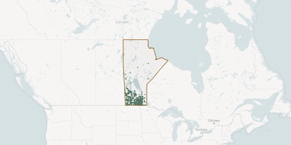 © OpenStreetMap
- Austin CemeteryGPS coordinates: 49.92686° N, 98.95065° W
- Austin Sommerfeld Mennonite Church CemeteryGPS coordinates: 49.93614° N, 98.97201° W
- Avonlea CemeteryGPS coordinates: 49.59102° N, 97.25295° W
- Baie Saint Paul Anglican CemeteryGPS coordinates: 50.05031° N, 97.83675° W
- Balmoral Victoria (Victoria Presbyterian) CemeteryGPS coordinates: 50.24059° N, 97.28885° W
- Beaconsfield Cemetery, ManitobaGPS coordinates: 49.50206° N, 98.70437° W
- Beaver Creek CemeteryGPS coordinates: 50.01887° N, 98.71927° W
- Bede CemeteryGPS coordinates: 49.39979° N, 100.96354° W
- Belgian Sacred Heart CemeteryGPS coordinates: 49.89371° N, 97.10563° W
- Bellsite CemeteryGPS coordinates: 52.58492° N, 101.08350° W
- Belmont Hillside CemeteryGPS coordinates: 49.40654° N, 99.47283° W
- Benito Community CemeteryGPS coordinates: 51.91030° N, 101.54943° W
- Bennett CemeteryGPS coordinates: 49.97494° N, 100.97032° W
- Bergfeld Evangelical Mennonite CemeteryGPS coordinates: 49.13326° N, 97.70730° W
- Bethany South CemeteryGPS coordinates: 50.93402° N, 101.25103° W
- Bethel CemeteryGPS coordinates: 50.21156° N, 98.03383° W
- Bethel CemeteryGPS coordinates: 49.29637° N, 97.95685° W
- Bethel Presbyterian CemeteryGPS coordinates: 49.65083° N, 98.77656° W
- Bethlehem Memorial Gardens / Bethlehem Lutheran CemeteryGPS coordinates: 49.83443° N, 97.64196° W
- Bield CemeteryGPS coordinates: 51.23584° N, 101.16579° W
- Birch River Community CemeteryGPS coordinates: 49.74932° N, 95.84904° W
- Bird River CemeteryGPS coordinates: 50.40370° N, 95.74044° W
- Birnie CemeteryGPS coordinates: 50.43289° N, 99.43869° W
- Birtle CemeteryGPS coordinates: 50.41861° N, 101.02848° W
- Blessed Sacrament Roman Catholic CemeteryGPS coordinates: 49.89968° N, 97.76228° W
- Blessed Virgin Mary Ukrainian Catholic CemeteryGPS coordinates: 50.09775° N, 97.02264° W
- Blessed Virgin Mary Ukrainian Catholic CemeteryGPS coordinates: 51.45613° N, 99.52779° W
- Bluff Creek or St James Anglican CemeteryGPS coordinates: 50.81633° N, 98.83444° W
- Blumenfeld Mennonite (1878-1978) CemeteryGPS coordinates: 49.05213° N, 97.95297° W
- Blumenhof Community CemeteryGPS coordinates: 49.58965° N, 96.66330° W