
New Brunswick
490 known cemeteries in New Brunswick, Canada.
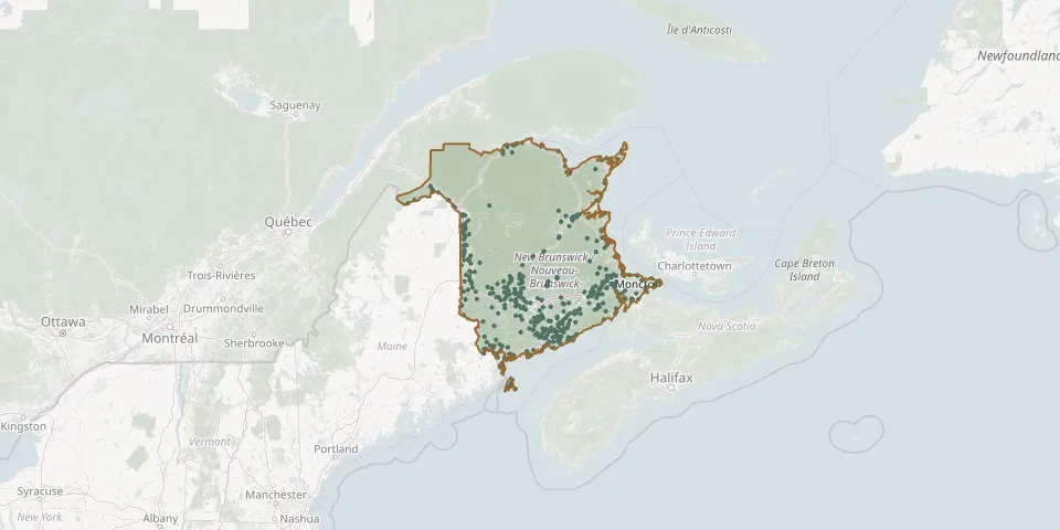 © OpenStreetMap
- Bleakney CemeteryGPS coordinates: 45.94902° N, 65.17306° W
- Blissville United Baptist Church CemeteryGPS coordinates: 45.60864° N, 66.56160° W
- Bocabec Highway 127 CemeteryGPS coordinates: 45.17538° N, 66.98761° W
- Bocabec United Church CemeteryGPS coordinates: 45.18044° N, 66.99006° W
- Boom Road Presbyterian CemeteryGPS coordinates: 46.95279° N, 65.78570° W
- Boundary Creek CemeteryGPS coordinates: 46.05675° N, 64.98934° W
- Bradshaw CemeteryGPS coordinates: 45.36434° N, 65.52886° W
- Bright CemeteryGPS coordinates: 46.05301° N, 66.89812° W
- Bright CemeteryGPS coordinates: 46.10232° N, 67.05268° W
- Brockway CemeteryGPS coordinates: 45.52397° N, 67.11704° W
- Browns CemeteryGPS coordinates: 45.31896° N, 65.65255° W
- Browns Flat United BaptistGPS coordinates: 45.47159° N, 66.13349° W
- Burton (Bell) CemeteryGPS coordinates: 45.83783° N, 66.39191° W
- Burton Cemetery Mount DouglasGPS coordinates: 45.47291° N, 66.33220° W
- Burtts Corner CemeteryGPS coordinates: 46.05857° N, 66.86276° W
- Burtts Corner CemeteryGPS coordinates: 46.13750° N, 66.92721° W
- Byno CemeteryGPS coordinates: 45.90778° N, 66.25722° W
- California Settlement Community CemeteryGPS coordinates: 46.90288° N, 67.78014° W
- Calvary CemeteryGPS coordinates: 46.15009° N, 67.59474° W
- Campbellton Rural CemeteryGPS coordinates: 47.99957° N, 66.69589° W
- Canterbury CemeteryGPS coordinates: 45.89329° N, 67.46375° W
- Cardwell Family Cemetery (possibly Gifford)GPS coordinates: 45.84155° N, 65.22821° W
- Carleton County CemeteryGPS coordinates: 46.02054° N, 67.63985° W
- Carlisle CemeteryGPS coordinates: 45.97738° N, 66.71244° W
- Carvell CemeteryGPS coordinates: 46.36135° N, 67.76958° W
- Catholic Cemetery of Saint AndrewsGPS coordinates: 45.09819° N, 67.06972° W
- Cedar Hill CemeteryGPS coordinates: 45.25257° N, 66.08196° W
- Cedar Hill Greenwood CemeteriesGPS coordinates: 45.23603° N, 66.12262° W
- Cemetery #11, HampsteadGPS coordinates: 45.67457° N, 66.17592° W
- Cemetery #12, HampsteadGPS coordinates: 45.66214° N, 66.16185° W