
Ontario
2,347 known cemeteries in Ontario, Canada.
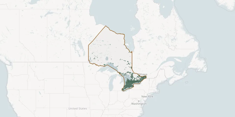 © OpenStreetMap
- Campbell CemeteryGPS coordinates: 42.45320° N, 81.94510° W
- Campbell CemeteryGPS coordinates: 42.96251° N, 81.43209° W
- Campbellville Burying Ground CemeteryGPS coordinates: 43.48543° N, 79.98213° W
- Canborough CemeteryGPS coordinates: 42.99232° N, 79.67389° W
- Canniff Mills CemeteryGPS coordinates: 44.20588° N, 77.39124° W
- Canton CemeteryGPS coordinates: 43.99673° N, 78.34663° W
- Canton d'Armstrong CemeteryGPS coordinates: 47.71344° N, 79.83456° W
- Capital Memorial GardensGPS coordinates: 45.25625° N, 75.71303° W
- Capreol CemeteryGPS coordinates: 46.69597° N, 80.91330° W
- Carleton Place United CemeteriesGPS coordinates: 45.14113° N, 76.07984° W
- Carlisle United Church CemeteryGPS coordinates: 43.39180° N, 79.97620° W
- Carluke Road at Shaver Road CemeteryGPS coordinates: 43.14336° N, 79.99423° W
- Carman CemeteryGPS coordinates: 44.11385° N, 77.72367° W
- Carmel cemeteryGPS coordinates: 43.39090° N, 80.02429° W
- Carmel Methodist CemeteryGPS coordinates: 44.42328° N, 80.33667° W
- Carmichael CemeteryGPS coordinates: 43.07855° N, 81.29301° W
- Carpenter CemeteryGPS coordinates: 44.69846° N, 75.70467° W
- Carrick Baptist CemeteryGPS coordinates: 44.07294° N, 81.04365° W
- Carrville United Church CemeteryGPS coordinates: 43.84690° N, 79.46380° W
- Carrying Place CemeteryGPS coordinates: 44.04970° N, 77.58658° W
- Carrying Place Cemetery AnnexGPS coordinates: 44.05363° N, 77.59520° W
- Cartwright Union CemeteryGPS coordinates: 44.11556° N, 78.78241° W
- Case CemeteryGPS coordinates: 43.13378° N, 79.87108° W
- Cashel CemeteryGPS coordinates: 43.91790° N, 79.32360° W
- Cassburn CemeteryGPS coordinates: 45.58480° N, 74.70121° W
- Casselman CemeteryGPS coordinates: 45.31421° N, 75.08016° W
- Castlederg CemeteryGPS coordinates: 43.92564° N, 79.77811° W
- Castleford Union CemeteryGPS coordinates: 45.51018° N, 76.53975° W
- Castleton CemeteryGPS coordinates: 44.09750° N, 77.93202° W
- Cataraqui CemeteryGPS coordinates: 44.26563° N, 76.54139° W