
Ontario
2,347 known cemeteries in Ontario, Canada.
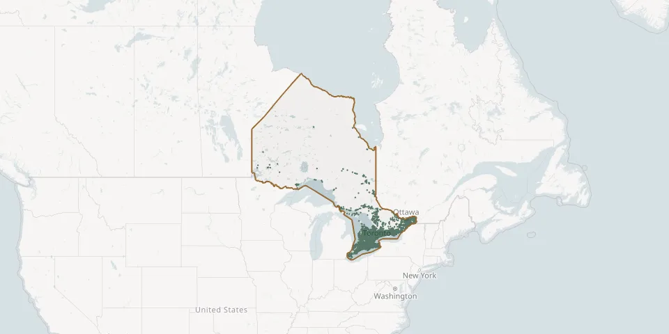 © OpenStreetMap
- St. Paul's Anglican Church- GrassmereGPS coordinates: 45.36586° N, 79.11037° W
- St. Paul's CemeteryGPS coordinates: 44.36116° N, 78.00410° W
- St. Paul’s Lutheran Cemetery NeustadtGPS coordinates: 44.06949° N, 81.00436° W
- St. Paul's Lutheran ChurchGPS coordinates: 43.80960° N, 81.00623° W
- St. Paul's Old Methodist Burying GroundGPS coordinates: 44.89662° N, 76.23661° W
- St. Paul's Presbyterian Cemetery-LintonGPS coordinates: 43.93558° N, 79.66115° W
- St. Paul's Presbyterian Church CemeteryGPS coordinates: 43.38639° N, 79.82966° W
- St. Paul's Presbyterian Church (Vaughan)GPS coordinates: 43.84288° N, 79.58754° W
- St Paul's United Church CemeteryGPS coordinates: 45.20081° N, 75.82805° W
- St. Peter's Anglican ChurchGPS coordinates: 43.54352° N, 79.65941° W
- St Peter's CemeteryGPS coordinates: 43.25618° N, 81.46218° W
- St. Peter’s Church CemeteryGPS coordinates: 42.60633° N, 81.43923° W
- St. Peter's Evangelical Lutheran CemeteryGPS coordinates: 42.56376° N, 81.61627° W
- St. Peter's Lutheran CemeteryGPS coordinates: 44.37027° N, 80.94287° W
- St. Peter's Roman Catholic CemeteryGPS coordinates: 42.95643° N, 80.70719° W
- St. Peter's West Essa Anglican CemeteryGPS coordinates: 44.18572° N, 79.85088° W
- St. Philip's Cemetery Walters FallsGPS coordinates: 44.49052° N, 80.71012° W
- St. Philip’s Church Anglican CemeteryGPS coordinates: 43.88462° N, 79.31627° W
- St. Philip's Churchyard CemeteryGPS coordinates: 43.70079° N, 79.53318° W
- St. Philips Roman Catholic CemeteryGPS coordinates: 45.18563° N, 75.83793° W
- Strabane United Church CemeteryGPS coordinates: 43.37894° N, 80.03376° W
- Strachan Avenue Burial groundsGPS coordinates: 43.63820° N, 79.40948° W
- Straffordville CemeteryGPS coordinates: 42.74881° N, 80.78882° W
- St. Raphael's CemeteryGPS coordinates: 45.21197° N, 74.59614° W
- Strathroy Municipal CemeteryGPS coordinates: 42.94607° N, 81.63844° W
- Streetsville CemeteryGPS coordinates: 43.57965° N, 79.70385° W
- Streetsville Memorial CemeteryGPS coordinates: 43.57886° N, 79.70895° W
- Strickland CemeteryGPS coordinates: 49.28893° N, 81.88157° W
- Strong Community CemeteryGPS coordinates: 45.77790° N, 79.39936° W
- Stroud (St. James) CemeteryGPS coordinates: 44.32392° N, 79.62120° W