
Región de Atacama
18 known cemeteries in Región de Atacama, Chile.
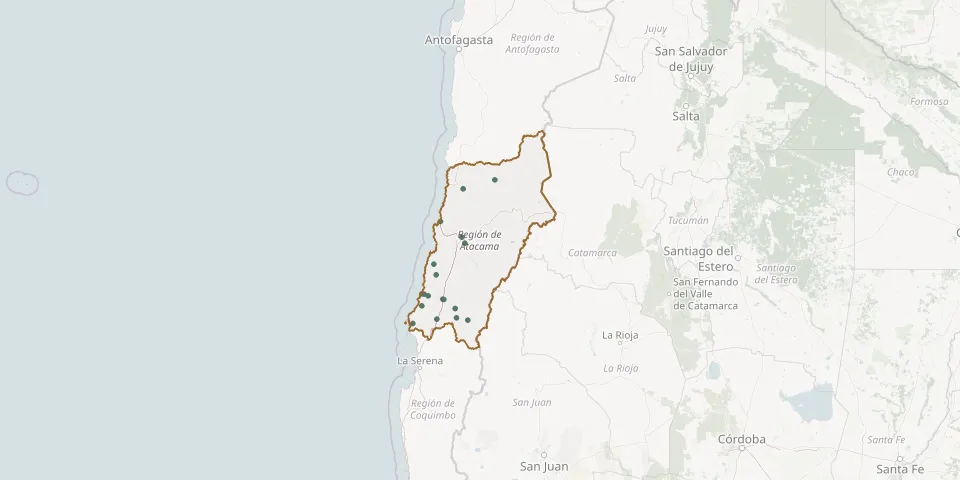 © OpenStreetMap
- Alto del Carmen CemeteryGPS coordinates: 28.75528° S, 70.48705° W
- Caldera Lego CemeteryGPS coordinates: 27.06728° S, 70.81386° W
- Carrizal Alto CemeteryGPS coordinates: 28.10617° S, 70.90532° W
- Chañaral de Aceituno CemeteryGPS coordinates: 29.04332° S, 71.41856° W
- Copiapó Municipal CemeteryGPS coordinates: 27.37245° S, 70.33867° W
- Domeyko CemeteryGPS coordinates: 28.95950° S, 70.88870° W
- El Salado CemeteryGPS coordinates: 26.42546° S, 70.31410° W
- El Salvador CemeteryGPS coordinates: 26.24931° S, 69.61603° W
- El Totoral CemeteryGPS coordinates: 27.90024° S, 70.95689° W
- Freirina Municipal CemeteryGPS coordinates: 28.51029° S, 71.07795° W
- Huasco Bajo CemeteryGPS coordinates: 28.47818° S, 71.17268° W
- Huasco CemeteryGPS coordinates: 28.47102° S, 71.22201° W
- La Plata CemeteryGPS coordinates: 28.97864° S, 70.20871° W
- Quebradita CemeteryGPS coordinates: 28.70496° S, 71.22249° W
- San Félix CemeteryGPS coordinates: 28.93137° S, 70.45887° W
- Tierra Amarilla Municipal CemeteryGPS coordinates: 27.49056° S, 70.27334° W
- Vallenar Municipal CemeteryGPS coordinates: 28.57181° S, 70.75698° W
- Vallenar Park CemeteryGPS coordinates: 28.57967° S, 70.73989° W