
Cauca
60 known cemeteries in Cauca, Colombia.
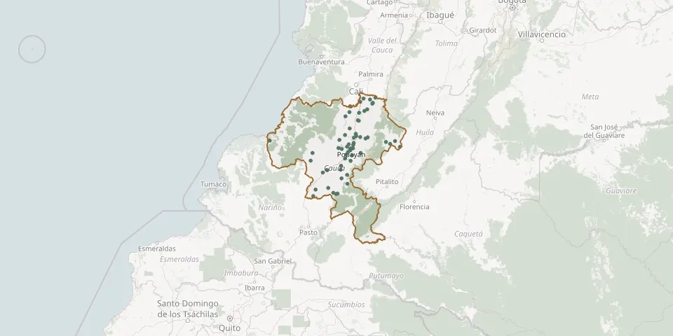 © OpenStreetMap
- Antomoreno Bajo CemeteryGPS coordinates: 2.41893° N, 76.62572° W
- Argelia Central CemeteryGPS coordinates: 2.25981° N, 77.24549° W
- Bolívar Municipal CemeteryGPS coordinates: 1.82937° N, 76.97046° W
- Buenos Aires CemeteryGPS coordinates: 3.01837° N, 76.63747° W
- Cajete CemeteryGPS coordinates: 2.47692° N, 76.67498° W
- Cajibío Central CemeteryGPS coordinates: 2.62001° N, 76.56790° W
- Calibío CemeteryGPS coordinates: 2.53768° N, 76.57146° W
- Caloto CemeteryGPS coordinates: 3.03648° N, 76.40297° W
- Chiribio CemeteryGPS coordinates: 2.34417° N, 76.59782° W
- Cimarronas CemeteryGPS coordinates: 1.74189° N, 76.82428° W
- Corinto CemeteryGPS coordinates: 3.16634° N, 76.27000° W
- Corinto CemeteryGPS coordinates: 3.15255° N, 76.27920° W
- El Carmelo CemeteryGPS coordinates: 2.66306° N, 76.70632° W
- El Palo Hamlet CemeteryGPS coordinates: 3.06530° N, 76.35830° W
- El Tambo CemeteryGPS coordinates: 2.45625° N, 76.80990° W
- El Turco CemeteryGPS coordinates: 2.89177° N, 76.50334° W
- Guachicono Central CemeteryGPS coordinates: 2.03556° N, 76.67429° W
- Guapi CemeteryGPS coordinates: 2.57419° N, 77.88657° W
- Inza CemeteryGPS coordinates: 2.55046° N, 76.06385° W
- Itaibe CemeteryGPS coordinates: 2.47563° N, 75.84427° W
- Jardines de Paz Cemetery, PopayánGPS coordinates: 2.50456° N, 76.57747° W
- La Cabaña Cemetery, TimbíoGPS coordinates: 2.39577° N, 76.65921° W
- La Sierra Catholic Municipal CemeteryGPS coordinates: 2.17788° N, 76.76754° W
- Las Yescas CemeteryGPS coordinates: 2.29036° N, 76.70578° W
- Los Milagros CemeteryGPS coordinates: 1.75458° N, 76.89142° W
- Manizales Hamlet CemeteryGPS coordinates: 2.44007° N, 76.75931° W
- Mercaderes CemeteryGPS coordinates: 1.70205° N, 77.20512° W
- Mercaderes CemeteryGPS coordinates: 1.80374° N, 77.16937° W
- Morales Municipal CemeteryGPS coordinates: 2.76232° N, 76.63306° W
- Nuestra Señora de las Mercedes CemeteryGPS coordinates: 2.10977° N, 76.98384° W