
Nariño
34 known cemeteries in Nariño, Colombia.
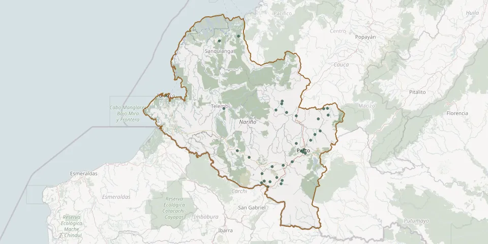 © OpenStreetMap
- Aldana CemeteryGPS coordinates: 0.88503° N, 77.70210° W
- Barbacoas General CemeteryGPS coordinates: 1.66858° N, 78.13788° W
- Buesaco CemeteryGPS coordinates: 1.38805° N, 77.15455° W
- Carlosama CemeteryGPS coordinates: 0.86622° N, 77.73115° W
- Córdoba CemeteryGPS coordinates: 0.85520° N, 77.52178° W
- Cumbitara Municipal CemeteryGPS coordinates: 1.65054° N, 77.57583° W
- El Ejido CemeteryGPS coordinates: 1.71916° N, 77.51366° W
- El Manzano CemeteryGPS coordinates: 1.58992° N, 77.35694° W
- Guachucal CemeteryGPS coordinates: 0.96415° N, 77.72643° W
- Gualmatán Parish CemeteryGPS coordinates: 0.92369° N, 77.56782° W
- Imués CemeteryGPS coordinates: 1.05443° N, 77.49814° W
- Iscuandé Municipal CemeteryGPS coordinates: 2.44896° N, 77.98086° W
- Jamondino Township CemeteryGPS coordinates: 1.18387° N, 77.25968° W
- Jardín de las Mercedes Cemetery, PastoGPS coordinates: 1.19707° N, 77.28572° W
- Las Mercedes Park CemeteryGPS coordinates: 1.42590° N, 77.09840° W
- La Tola Municipal CemeteryGPS coordinates: 2.39879° N, 78.18869° W
- Madrigal CemeteryGPS coordinates: 1.74869° N, 77.50893° W
- María Inmaculada CemeteryGPS coordinates: 1.29084° N, 77.35699° W
- Nuestra Señora de Belén CemeteryGPS coordinates: 1.59642° N, 77.01211° W
- Nuestra Señora del Carmen CemeteryGPS coordinates: 1.22462° N, 77.27375° W
- Piedrancha CemeteryGPS coordinates: 1.13985° N, 77.86531° W
- Policarpa CemeteryGPS coordinates: 1.62648° N, 77.46141° W
- Puerres CemeteryGPS coordinates: 0.89197° N, 77.50809° W
- Punto papa CemeteryGPS coordinates: 0.82280° N, 77.66367° W
- Pupiales CemeteryGPS coordinates: 0.87633° N, 77.64020° W
- Ricaurte CemeteryGPS coordinates: 1.21210° N, 77.99369° W
- San Juan de Anganoy CemeteryGPS coordinates: 1.21112° N, 77.30238° W
- San Pablo CemeteryGPS coordinates: 1.66921° N, 77.01888° W
- San Pedro de Cartago CemeteryGPS coordinates: 1.55588° N, 77.11885° W
- Sapuyes CemeteryGPS coordinates: 1.04089° N, 77.61672° W