
Guanacaste
72 known cemeteries in Guanacaste, Costa Rica.
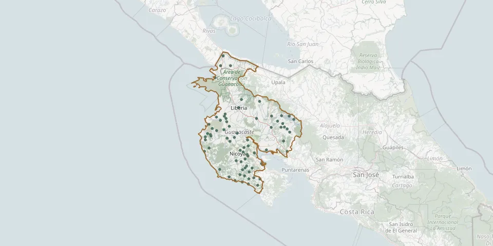 © OpenStreetMap
- Bagaces Municipal CemeteryGPS coordinates: 10.52100° N, 85.25186° W
- Barra Honda CemeteryGPS coordinates: 10.13962° N, 85.35320° W
- Barra Honda CemeteryGPS coordinates: 10.12358° N, 85.34356° W
- Belén CemeteryGPS coordinates: 10.40105° N, 85.59944° W
- Bernabela CemeteryGPS coordinates: 10.31287° N, 85.56684° W
- Caballito CemeteryGPS coordinates: 10.23130° N, 85.33934° W
- Caimital CemeteryGPS coordinates: 10.07473° N, 85.47075° W
- Campo Santo de HuacasGPS coordinates: 10.01880° N, 85.35892° W
- Cañas CemeteryGPS coordinates: 10.42624° N, 85.09492° W
- Cartagena CemeteryGPS coordinates: 10.39190° N, 85.67960° W
- Colonia del Valle CemeteryGPS coordinates: 9.88327° N, 85.33384° W
- Comunidad CemeteryGPS coordinates: 10.54396° N, 85.59587° W
- Copal Cemetery, NicoyaGPS coordinates: 10.15573° N, 85.27376° W
- Corralillo CemeteryGPS coordinates: 10.21441° N, 85.38559° W
- Cuajiniquil CemeteryGPS coordinates: 10.94947° N, 85.69433° W
- Curubandé Liberia CemeteryGPS coordinates: 10.72004° N, 85.41274° W
- El Dos CemeteryGPS coordinates: 10.37663° N, 84.89720° W
- El Llano CemeteryGPS coordinates: 10.35175° N, 85.74477° W
- Guardia CemeteryGPS coordinates: 10.56686° N, 85.58686° W
- Guayabo CemeteryGPS coordinates: 10.70039° N, 85.21994° W
- Hojancha CemeteryGPS coordinates: 10.06454° N, 85.41664° W
- Huacas CemeteryGPS coordinates: 10.36130° N, 85.77530° W
- Jabillos CemeteryGPS coordinates: 9.88307° N, 85.21577° W
- Junquillal CemeteryGPS coordinates: 10.17495° N, 85.80814° W
- La Cruz Municipal CemeteryGPS coordinates: 11.07673° N, 85.63626° W
- La Garita CemeteryGPS coordinates: 11.07680° N, 85.53005° W
- Las Juntas CemeteryGPS coordinates: 10.28186° N, 84.96367° W
- La Union CemeteryGPS coordinates: 10.51043° N, 84.85280° W
- Líbano CemeteryGPS coordinates: 10.42863° N, 84.98975° W
- Liberia Municipal CemeteryGPS coordinates: 10.63584° N, 85.44204° W