
Heredia
23 known cemeteries in Heredia, Costa Rica.
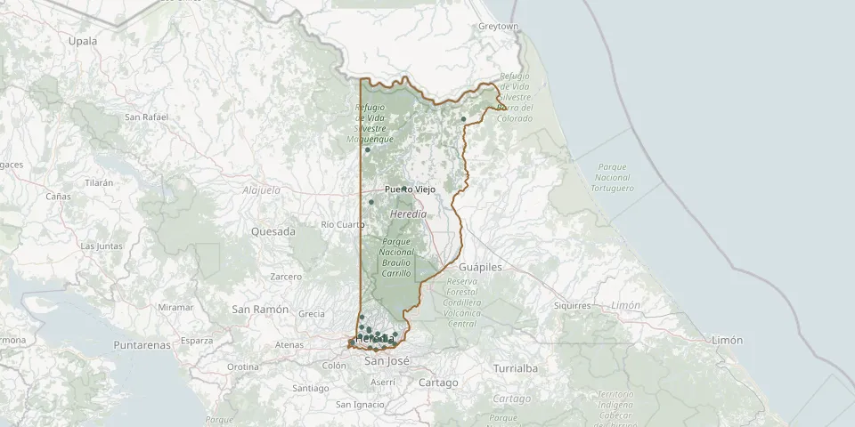 © OpenStreetMap
- Barreal de Heredia CemeteryGPS coordinates: 9.96926° N, 84.13261° W
- Barva Municipal CemeteryGPS coordinates: 10.01980° N, 84.13510° W
- Belén Municipal CemeteryGPS coordinates: 9.98579° N, 84.18640° W
- Campo de Paz Cemetery, San PabloGPS coordinates: 10.00414° N, 84.08767° W
- Extranjeros CemeteryGPS coordinates: 10.00099° N, 84.14318° W
- Flores CemeteryGPS coordinates: 10.00523° N, 84.16259° W
- Heredia Central Municipal CemeteryGPS coordinates: 9.99107° N, 84.11761° W
- Jardines del Recuerdo CemeteryGPS coordinates: 9.96360° N, 84.11416° W
- Jardines de Vida Heredia CemeteryGPS coordinates: 9.99261° N, 84.08524° W
- Jardín La Esperanza Silencio y Paz CemeteryGPS coordinates: 10.02698° N, 84.13611° W
- La Piedad Santo Tomás CemeteryGPS coordinates: 9.98748° N, 84.06991° W
- La Virgen CemeteryGPS coordinates: 10.41225° N, 84.12863° W
- Llanuras del Gaspar Village CemeteryGPS coordinates: 10.66459° N, 83.84427° W
- Mercedes Norte CemeteryGPS coordinates: 10.00350° N, 84.12811° W
- Puerto Viejo CemeteryGPS coordinates: 10.45335° N, 84.02740° W
- San Bosco CemeteryGPS coordinates: 10.06249° N, 84.15688° W
- San Isidro CemeteryGPS coordinates: 10.01049° N, 84.05414° W
- San Juan Pangola CemeteryGPS coordinates: 10.57094° N, 84.13969° W
- San Miguel CemeteryGPS coordinates: 9.98107° N, 84.05642° W
- San Pablo CemeteryGPS coordinates: 9.99417° N, 84.10178° W
- San Rafael CemeteryGPS coordinates: 10.01232° N, 84.10817° W
- Santa Bárbara CemeteryGPS coordinates: 10.03205° N, 84.15786° W
- Santo Domingo CemeteryGPS coordinates: 9.96941° N, 84.08841° W