
Pardubice Region
393 known cemeteries in Pardubice Region, Czechia.
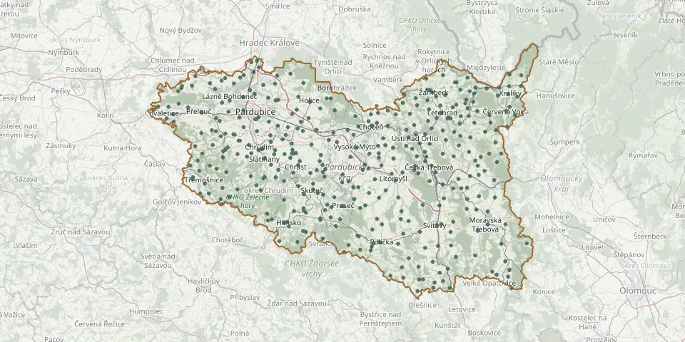 © OpenStreetMap
- Slatiňany Evangelical Cemetery, KunčíGPS coordinates: 49.90697° N, 15.83842° E
- Slepotice CemeteryGPS coordinates: 49.99066° N, 15.96171° E
- Sloupnice Evangelical CemeteryGPS coordinates: 49.92276° N, 16.31049° E
- Smrček CemeteryGPS coordinates: 49.86685° N, 15.88865° E
- Sobětuchy CemeteryGPS coordinates: 49.93554° N, 15.76274° E
- Sruby CemeteryGPS coordinates: 50.00171° N, 16.17460° E
- Staré Ždánice CemeteryGPS coordinates: 50.12291° N, 15.71924° E
- Stašov CemeteryGPS coordinates: 49.67416° N, 16.36886° E
- St. Catherine Churchyard, Kunčice near LetohradGPS coordinates: 50.02400° N, 16.52031° E
- Stolany CemeteryGPS coordinates: 49.92717° N, 15.74617° E
- Stradouň CemeteryGPS coordinates: 49.96810° N, 16.06075° E
- Strážná CemeteryGPS coordinates: 49.91354° N, 16.70794° E
- Studené CemeteryGPS coordinates: 50.06843° N, 16.59048° E
- St. Wenceslas Cemetery, ChrudimGPS coordinates: 49.94611° N, 15.80395° E
- Sudslava CemeteryGPS coordinates: 50.04102° N, 16.28814° E
- Svitavy CemeteryGPS coordinates: 49.75682° N, 16.47645° E
- Svitavy Jewish CemeteryGPS coordinates: 49.75958° N, 16.49424° E
- Svratouch CemeteryGPS coordinates: 49.72320° N, 16.03699° E
- Tatenice CemeteryGPS coordinates: 49.86872° N, 16.69730° E
- Těchonín CemeteryGPS coordinates: 50.06316° N, 16.61717° E
- Telecí Evangelical CemeteryGPS coordinates: 49.69573° N, 16.18188° E
- Tisová Vysoké Mýto CemeteryGPS coordinates: 49.93440° N, 16.21709° E
- Třebosice CemeteryGPS coordinates: 50.00009° N, 15.73322° E
- Třebovice u Lanškrouna CemeteryGPS coordinates: 49.85831° N, 16.49979° E
- Trnávka CemeteryGPS coordinates: 50.03180° N, 15.46175° E
- Trojovice CemeteryGPS coordinates: 49.93465° N, 15.91937° E
- Trpík CemeteryGPS coordinates: 49.84850° N, 16.57117° E
- Trpín CemeteryGPS coordinates: 49.59249° N, 16.40268° E
- Trstěnice u Litomyšle CemeteryGPS coordinates: 49.79104° N, 16.34073° E
- Turkish Military CemeteryGPS coordinates: 50.02020° N, 15.77785° E