
Plzeň Region
410 known cemeteries in Plzeň Region, Czechia.
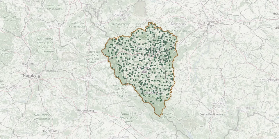 © OpenStreetMap
- Černošín CemeteryGPS coordinates: 49.81069° N, 12.88031° E
- Červené Dřevo Cemetery (Rothenbaum)GPS coordinates: 49.29670° N, 13.04169° E
- Česká Bříza CemeteryGPS coordinates: 49.82719° N, 13.41883° E
- Chanovice CemeteryGPS coordinates: 49.40831° N, 13.71483° E
- Cheznovice CemeteryGPS coordinates: 49.78526° N, 13.77002° E
- Chlístov CemeteryGPS coordinates: 49.31612° N, 13.36130° E
- Chlístov Jewish CemeteryGPS coordinates: 49.32723° N, 13.36522° E
- Chlumčany CemeteryGPS coordinates: 49.63489° N, 13.31011° E
- Chodová Planá CemeteryGPS coordinates: 49.88792° N, 12.72636° E
- Chodová Planá Old Jewish CemeteryGPS coordinates: 49.89252° N, 12.72501° E
- Chodský Újezd CemeteryGPS coordinates: 49.84008° N, 12.69017° E
- Chodský Újezd CemeteryGPS coordinates: 49.86700° N, 12.65336° E
- Chomle CemeteryGPS coordinates: 49.86224° N, 13.63335° E
- Chomle Jewish CemeteryGPS coordinates: 49.85458° N, 13.62993° E
- Chotíkov CemeteryGPS coordinates: 49.78833° N, 13.32601° E
- Chříč CemeteryGPS coordinates: 49.97447° N, 13.65319° E
- Chudenice CemeteryGPS coordinates: 49.46317° N, 13.16578° E
- Church of St. James the Greater Churchyard, PodbořánkyGPS coordinates: 50.05252° N, 13.44857° E
- Chválenice CemeteryGPS coordinates: 49.63460° N, 13.47907° E
- Čívice CemeteryGPS coordinates: 49.88040° N, 13.50989° E
- Čižice CemeteryGPS coordinates: 49.64492° N, 13.39953° E
- Čížkov CemeteryGPS coordinates: 49.54085° N, 13.68602° E
- Ctiboř CemeteryGPS coordinates: 49.82667° N, 12.60231° E
- Damnov CemeteryGPS coordinates: 49.78428° N, 12.79861° E
- Dešenice CemeteryGPS coordinates: 49.26486° N, 13.21886° E
- Dlažov CemeteryGPS coordinates: 49.36186° N, 13.16489° E
- Dlouhá Ves CemeteryGPS coordinates: 49.19379° N, 13.51172° E
- Dlouhá Ves CemeteryGPS coordinates: 49.17217° N, 13.50767° E
- Dlouhá Ves Jewish CemeteryGPS coordinates: 49.19332° N, 13.51741° E
- Dlouhý Újezd Jewish CemeteryGPS coordinates: 49.76431° N, 12.61387° E