
Zlín Region
262 known cemeteries in Zlín Region, Czechia.
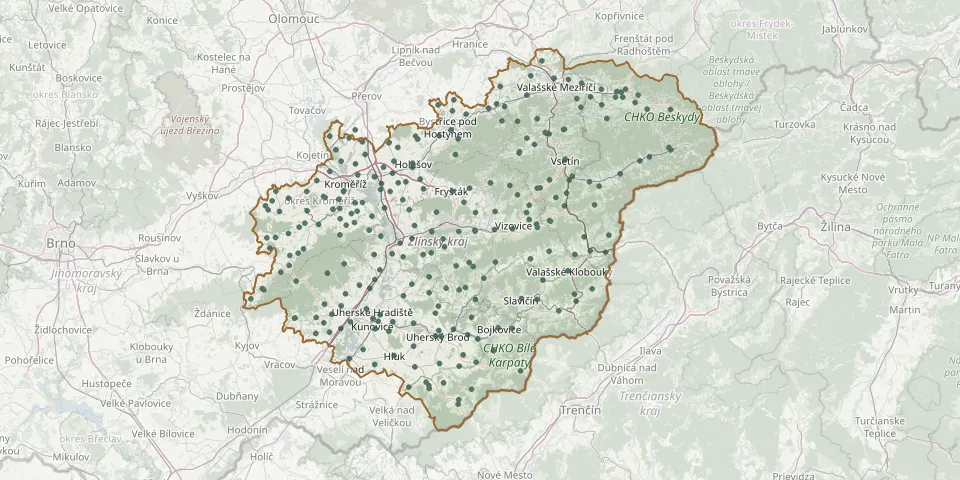 © OpenStreetMap
- Ostrožská Lhota CemeteryGPS coordinates: 48.97403° N, 17.47280° E
- Provodov Former CemeteryGPS coordinates: 49.15755° N, 17.73217° E
- Rožnov Old CemeteryGPS coordinates: 49.46386° N, 18.13841° E
- Rožnov pod Radhoštěm Evangelical CemeteryGPS coordinates: 49.46837° N, 18.16129° E
- Rusava CemeteryGPS coordinates: 49.35141° N, 17.69454° E
- Štítná nad Vláří CemeteryGPS coordinates: 49.07058° N, 17.97849° E
- Střítež nad Bečvou CemeteryGPS coordinates: 49.45449° N, 18.06489° E
- Uherské Hradiště Former Jewish CemeteryGPS coordinates: 49.05731° N, 17.46795° E
- Uherský Brod New Jewish CemeteryGPS coordinates: 49.02524° N, 17.65438° E
- Ústí CemeteryGPS coordinates: 49.30522° N, 18.00617° E
- Valašská Bystřice CemeteryGPS coordinates: 49.41558° N, 18.10983° E
- Valašská Polanka CemeteryGPS coordinates: 49.25951° N, 17.99335° E
- Valašské Meziříčí Jewish CemeteryGPS coordinates: 49.48750° N, 17.96540° E
- Velké Karlovice Jewish CemeteryGPS coordinates: 49.36393° N, 18.28019° E
- Veselá CemeteryGPS coordinates: 49.45165° N, 18.02761° E
- Veselá Old CemeteryGPS coordinates: 49.45143° N, 18.02764° E
- Vidče CemeteryGPS coordinates: 49.44031° N, 18.09639° E
- Vítonice Cemetery near Bystřice pod HostýnemGPS coordinates: 49.44931° N, 17.68938° E
- Vlachovice CemeteryGPS coordinates: 49.12586° N, 17.93461° E
- Vsetín Municipal CemeteryGPS coordinates: 49.34296° N, 17.99580° E
- Zděchov CemeteryGPS coordinates: 49.26143° N, 18.07647° E
- Zlín Louky nad Dřevnicí CemeteryGPS coordinates: 49.21320° N, 17.62950° E