
Monte Cristi
18 known cemeteries in Monte Cristi, Dominican Republic.
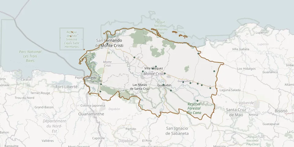 © OpenStreetMap
- Arroyo Caña CemeteryGPS coordinates: 19.72866° N, 71.17439° W
- Cana Chapetón CemeteryGPS coordinates: 19.60393° N, 71.24933° W
- Carbonera Neighbourhood Municipal CemeteryGPS coordinates: 19.64323° N, 71.68466° W
- Castañuelas Municipal CemeteryGPS coordinates: 19.72772° N, 71.49429° W
- Doña Antonia CemeteryGPS coordinates: 19.66983° N, 71.23034° W
- El Copey Municipal CemeteryGPS coordinates: 19.67383° N, 71.68229° W
- El Duro CemeteryGPS coordinates: 19.78701° N, 71.53252° W
- El Papayo Rural CemeteryGPS coordinates: 19.80338° N, 71.24605° W
- Guayubín CemeteryGPS coordinates: 19.67150° N, 71.40210° W
- Hatillo Palma CemeteryGPS coordinates: 19.65739° N, 71.19228° W
- Hato del Medio Arriba CemeteryGPS coordinates: 19.68281° N, 71.31377° W
- La Guajaca CemeteryGPS coordinates: 19.67640° N, 71.24879° W
- Ranchadero CemeteryGPS coordinates: 19.64736° N, 71.36851° W
- San Fernando Montecristi New CemeteryGPS coordinates: 19.84437° N, 71.65363° W
- Villa Lobos CemeteryGPS coordinates: 19.67897° N, 71.28130° W
- Villa Sinda CemeteryGPS coordinates: 19.71938° N, 71.39589° W
- Villa Vásquez Municipal CemeteryGPS coordinates: 19.73995° N, 71.45017° W
- Villa Vásquez New CemeteryGPS coordinates: 19.74848° N, 71.43590° W