
Cañar
18 known cemeteries in Cañar, Ecuador.
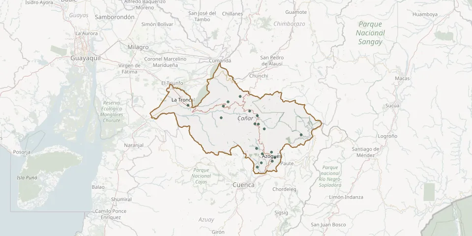 © OpenStreetMap
- Buena Muerte CemeteryGPS coordinates: 2.72585° S, 78.89996° W
- Cañar Municipal CemeteryGPS coordinates: 2.55844° S, 78.94156° W
- Chontamarca Parish CemeteryGPS coordinates: 2.43577° S, 79.09175° W
- Cristo Rey-Solano General CemeteryGPS coordinates: 2.79950° S, 78.92868° W
- Ducur CemeteryGPS coordinates: 2.45942° S, 79.11779° W
- El Tambo Municipal CemeteryGPS coordinates: 2.51216° S, 78.92864° W
- General Morales CemeteryGPS coordinates: 2.40572° S, 79.02412° W
- Gualleturo CemeteryGPS coordinates: 2.52402° S, 79.13003° W
- Guapán CemeteryGPS coordinates: 2.71590° S, 78.84880° W
- Honorato Vásquez CemeteryGPS coordinates: 2.56013° S, 78.92170° W
- Juncal Parish CemeteryGPS coordinates: 2.48713° S, 78.97067° W
- Luis Cordero CemeteryGPS coordinates: 2.74674° S, 78.83004° W
- Pindilig Parish CemeteryGPS coordinates: 2.61937° S, 78.68343° W
- San Francisco de San Pedro CemeteryGPS coordinates: 2.58671° S, 78.88958° W
- San Nicolas CemeteryGPS coordinates: 2.77613° S, 78.90564° W
- Santiago Guaman CemeteryGPS coordinates: 2.69552° S, 78.93247° W
- Urbanización los Olivos CemeteryGPS coordinates: 2.76638° S, 78.84415° W
- Voluntad de Dios CemeteryGPS coordinates: 2.45446° S, 79.31450° W