
Imbabura
18 known cemeteries in Imbabura, Ecuador.
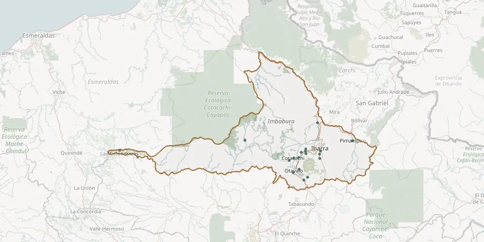 © OpenStreetMap
- Alianza Agato CemeteryGPS coordinates: 0.23692° N, 78.23228° W
- Caluqui-González Suárez CemeteryGPS coordinates: 0.17845° N, 78.20831° W
- Caranqui CemeteryGPS coordinates: 0.31938° N, 78.12196° W
- Chaltura CemeteryGPS coordinates: 0.34751° N, 78.19729° W
- Cotacachi CemeteryGPS coordinates: 0.29866° N, 78.26202° W
- Cuellaje CemeteryGPS coordinates: 0.39591° N, 78.52817° W
- La Esperanza CemeteryGPS coordinates: 0.29680° N, 78.12087° W
- Las Golondrinas CemeteryGPS coordinates: 0.34048° N, 79.21145° W
- Los Óvalos CemeteryGPS coordinates: 0.32193° N, 78.19597° W
- Natabuela CemeteryGPS coordinates: 0.33690° N, 78.19928° W
- Otavalo Indigenous CemeteryGPS coordinates: 0.21909° N, 78.26556° W
- Pimampiro CemeteryGPS coordinates: 0.39255° N, 77.94296° W
- Quiroga CemeteryGPS coordinates: 0.28522° N, 78.28731° W
- Salinas Parish CemeteryGPS coordinates: 0.49088° N, 78.13268° W
- San Miguel de Ibarra CemeteryGPS coordinates: 0.33736° N, 78.11608° W
- San Pablo CemeteryGPS coordinates: 0.19364° N, 78.18700° W
- San Roque CemeteryGPS coordinates: 0.30092° N, 78.23559° W
- Santa Martha Cemetery, AtuntaquiGPS coordinates: 0.32978° N, 78.22201° W