
Santa Ana
20 known cemeteries in Santa Ana, El Salvador.
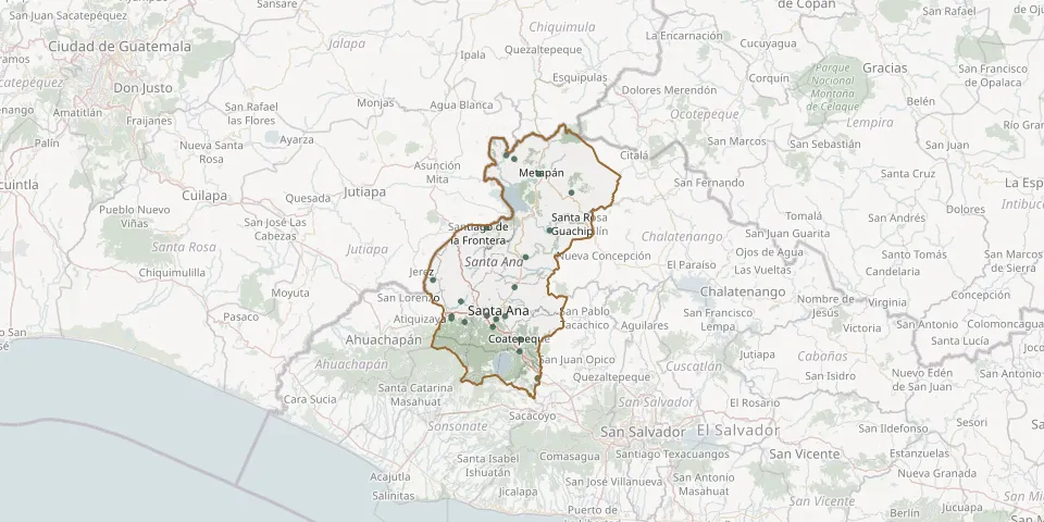 © OpenStreetMap
- Camones General CemeteryGPS coordinates: 14.05140° N, 89.51681° W
- Chalchuapa General CemeteryGPS coordinates: 13.98039° N, 89.67565° W
- Christ CemeteryGPS coordinates: 13.95494° N, 89.57133° W
- Coatepeque Municipal CemeteryGPS coordinates: 13.92334° N, 89.50254° W
- El Coco CemeteryGPS coordinates: 14.06921° N, 89.72304° W
- El Portezuelo Cemetery, Loma Linda NeighbourhoodGPS coordinates: 13.98175° N, 89.58579° W
- El Porvenir CemeteryGPS coordinates: 14.01660° N, 89.65179° W
- El Tinteral CemeteryGPS coordinates: 13.82838° N, 89.45917° W
- General Cemetery of San Sebastian SalitrilloGPS coordinates: 13.96579° N, 89.64270° W
- Jardines del Edén CemeteryGPS coordinates: 13.97474° N, 89.67604° W
- La Joya CemeteryGPS coordinates: 14.36550° N, 89.51719° W
- Las Flores Garden Memorial ParkGPS coordinates: 13.97325° N, 89.56357° W
- Masahuat Municipal CemeteryGPS coordinates: 14.19110° N, 89.42778° W
- Municipal Cemetery of MetapánGPS coordinates: 14.32903° N, 89.45412° W
- Municipal Cemetery Of The Municipality The CongoGPS coordinates: 13.89384° N, 89.50372° W
- San Antonio Pajonal CemeteryGPS coordinates: 14.19689° N, 89.58750° W
- San Jerónimo CemeteryGPS coordinates: 14.37459° N, 89.53780° W
- San Juan las Minas CemeteryGPS coordinates: 14.28258° N, 89.37273° W
- Santa Isabel Cemetery, Santa AnaGPS coordinates: 13.98062° N, 89.54035° W
- Texistepeque Municipal CemeteryGPS coordinates: 14.12530° N, 89.48864° W