
Sonsonate
18 known cemeteries in Sonsonate, El Salvador.
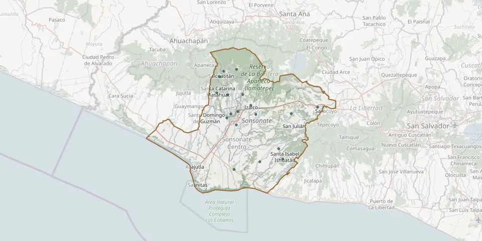 © OpenStreetMap
- Caluco Municipal CemeteryGPS coordinates: 13.72794° N, 89.66304° W
- Cantón El Presidio CemeteryGPS coordinates: 13.58140° N, 89.72278° W
- Cuisnahuat Municipal CemeteryGPS coordinates: 13.63672° N, 89.60015° W
- Izalco Municipal CemeteryGPS coordinates: 13.75171° N, 89.67699° W
- Juayúa Municipal CemeteryGPS coordinates: 13.84244° N, 89.75082° W
- Los Lagartos CemeteryGPS coordinates: 13.73007° N, 89.56607° W
- Municipal Cemetery ArmeniaGPS coordinates: 13.74690° N, 89.49411° W
- Nahuizalco Municipal CemeteryGPS coordinates: 13.77984° N, 89.74064° W
- Nahulingo Municipal CemeteryGPS coordinates: 13.70000° N, 89.71608° W
- Salcoatitán Municipal CemeteryGPS coordinates: 13.82784° N, 89.76152° W
- San Antonio del Monte CemeteryGPS coordinates: 13.71827° N, 89.74205° W
- San José La Majada Municipal CemeteryGPS coordinates: 13.84725° N, 89.71559° W
- San Lucas CemeteryGPS coordinates: 13.60197° N, 89.65232° W
- Santa Catarina Masahuat Municipal CemeteryGPS coordinates: 13.78501° N, 89.76981° W
- Santa Isabel Ishuatán Municipal CemeteryGPS coordinates: 13.60901° N, 89.58952° W
- Sonsonate General CemeteryGPS coordinates: 13.72895° N, 89.73139° W
- Sonzacate Municipal CemeteryGPS coordinates: 13.73552° N, 89.71241° W
- Talcomunca General CemeteryGPS coordinates: 13.78077° N, 89.69861° W