
Usulután
19 known cemeteries in Usulután, El Salvador.
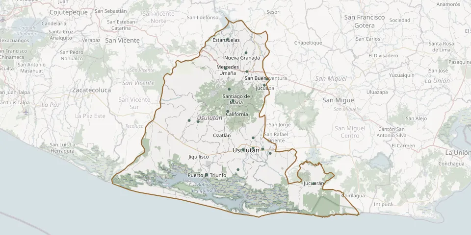 © OpenStreetMap
- Alegría CemeteryGPS coordinates: 13.50987° N, 88.48509° W
- Concepción Batres Municipal CemeteryGPS coordinates: 13.33498° N, 88.37027° W
- El Tempisque Subdivision Municipal CemeteryGPS coordinates: 13.60914° N, 88.43801° W
- El Triunfo District General Cemetery, Usulután NorteGPS coordinates: 13.55785° N, 88.43573° W
- Ereguayquin Municipal CemeteryGPS coordinates: 13.34645° N, 88.39134° W
- Estanzuelas Municipal CemeteryGPS coordinates: 13.64600° N, 88.49005° W
- General Cemetery of UsulutánGPS coordinates: 13.34498° N, 88.44675° W
- Jucuapa Municipal CemeteryGPS coordinates: 13.52065° N, 88.38689° W
- Jucuarán Municipal CemeteryGPS coordinates: 13.25210° N, 88.24918° W
- Mercedes Umaña Municipal CemeteryGPS coordinates: 13.56607° N, 88.49555° W
- Puerto El Triunfo Municipal CemeteryGPS coordinates: 13.27665° N, 88.54829° W
- San Agustín CemeteryGPS coordinates: 13.42429° N, 88.59720° W
- San Buenaventura Municipal CemeteryGPS coordinates: 13.53753° N, 88.38007° W
- San Dionisio Municipal CemeteryGPS coordinates: 13.29024° N, 88.46072° W
- San Francisco Javier General CemeteryGPS coordinates: 13.42127° N, 88.57223° W
- Santa Elena CemeteryGPS coordinates: 13.37704° N, 88.41858° W
- Santa María Municipal CemeteryGPS coordinates: 13.34867° N, 88.41902° W
- Santiago de Maria General CemeteryGPS coordinates: 13.47850° N, 88.47455° W
- Tecapán Municipal CemeteryGPS coordinates: 13.44988° N, 88.48957° W