
Ostrobothnia
86 known cemeteries in Ostrobothnia, Finland.
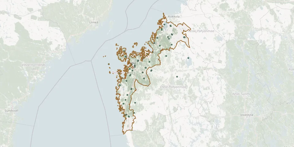 © OpenStreetMap
- Jeppo CemeteryGPS coordinates: 63.41050° N, 22.62804° E
- Johanne Cemetery, KronobyGPS coordinates: 63.54644° N, 23.51991° E
- Johanne Cemetery (New Esse)GPS coordinates: 63.58825° N, 23.07214° E
- Kaskö CemeteryGPS coordinates: 62.37552° N, 21.23627° E
- Klockarbacken Heroes' CemeteryGPS coordinates: 63.15110° N, 22.25495° E
- Korsholm New CemeteryGPS coordinates: 63.09370° N, 21.72610° E
- Korsnäs Church Village CemeteryGPS coordinates: 62.77127° N, 21.18767° E
- Kristinestad Heroes' CemeteryGPS coordinates: 62.27491° N, 21.37306° E
- Kristinestad New CemeteryGPS coordinates: 62.27360° N, 21.36100° E
- Kristinestads gamla gravgårdGPS coordinates: 62.27482° N, 21.38885° E
- Kronoby Heroes' CemeteryGPS coordinates: 63.72458° N, 23.02193° E
- Kuddnäs Heroes' CemeteryGPS coordinates: 63.53600° N, 22.53769° E
- Kullervo Regional CemeteryGPS coordinates: 63.09221° N, 21.72829° E
- Kvevlax CemeteryGPS coordinates: 63.17286° N, 21.85002° E
- Kvevlax Heroes' CemeteryGPS coordinates: 63.16320° N, 21.83903° E
- Kyrkbacken Heroes' CemeteryGPS coordinates: 62.93795° N, 21.57186° E
- Laihia CemeteryGPS coordinates: 62.97867° N, 22.01779° E
- Laihia Free CemeteryGPS coordinates: 62.87965° N, 22.05984° E
- Laihia Heroes' CemeteryGPS coordinates: 62.97633° N, 22.01198° E
- Lappajärvi CemeteryGPS coordinates: 63.21210° N, 23.64846° E
- Lappfjärd Heroes' CemeteryGPS coordinates: 62.24720° N, 21.52191° E
- Maijala CemeteryGPS coordinates: 63.01381° N, 22.33050° E
- Malax CemeteryGPS coordinates: 62.93780° N, 21.57260° E
- Maria Cemetery, ÖverbynGPS coordinates: 63.58905° N, 23.07322° E
- Marie Cemetery, MalaxGPS coordinates: 62.92790° N, 21.56061° E
- Maxmo CemeteryGPS coordinates: 63.22079° N, 22.04344° E
- Molpe CemeteryGPS coordinates: 62.88575° N, 21.27408° E
- Munsala gravgårdGPS coordinates: 63.45341° N, 22.43139° E
- Munsala Heroes' CemeteryGPS coordinates: 63.45383° N, 22.43257° E
- Napuen PuistoGPS coordinates: 62.97742° N, 22.00781° E