
Brittany
1,530 known cemeteries in Brittany, France.
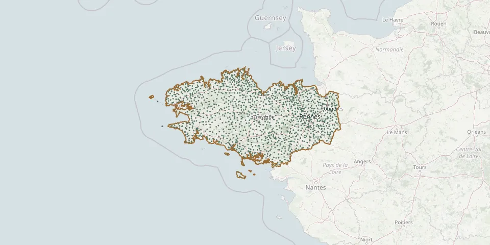 © OpenStreetMap
- Plobannalec-Lesconil Cemetery (church)GPS coordinates: 47.82344° N, 4.22815° W
- Plobannalec-Lesconil Cemetery (route de Saint Alour)GPS coordinates: 47.81646° N, 4.22772° W
- Plobannalec-Lesconil (D 102) CemeteryGPS coordinates: 47.80553° N, 4.22341° W
- Ploemel Cemetery (route de Pont Fol)GPS coordinates: 47.65370° N, 3.07162° W
- Ploërdut CemeteryGPS coordinates: 48.08961° N, 3.28262° W
- Ploeren Old CemeteryGPS coordinates: 47.65752° N, 2.86185° W
- Ploërmel CemeteryGPS coordinates: 47.93776° N, 2.40010° W
- Plœuc-sur-Lié CemeteryGPS coordinates: 48.34950° N, 2.75788° W
- Ploéven CemeteryGPS coordinates: 48.15591° N, 4.23349° W
- Ploëzal New CemeteryGPS coordinates: 48.71351° N, 3.20286° W
- Ploëzal Old CemeteryGPS coordinates: 48.71568° N, 3.20477° W
- Plogastel CemeteryGPS coordinates: 47.98085° N, 4.27193° W
- Plogoff CemeteryGPS coordinates: 48.03805° N, 4.66776° W
- Plogonnec CemeteryGPS coordinates: 48.07637° N, 4.19310° W
- Plomeur CemeteryGPS coordinates: 47.83897° N, 4.28247° W
- Plomeur ChurchyardGPS coordinates: 47.84094° N, 4.28397° W
- Plomodiern CemeteryGPS coordinates: 48.18297° N, 4.23065° W
- Plonéis CemeteryGPS coordinates: 48.01677° N, 4.21152° W
- Plonéour-Lanvern CemeteryGPS coordinates: 47.90325° N, 4.28758° W
- Plonévez-du-Faou CemeteryGPS coordinates: 48.25473° N, 3.82948° W
- Plonévez-du-Faou Cemetery (Saint Herbot)GPS coordinates: 48.32692° N, 3.80813° W
- Plonévez-Porzay CemeteryGPS coordinates: 48.12641° N, 4.21777° W
- Plorec-sur-Arguenon CemeteryGPS coordinates: 48.47826° N, 2.29396° W
- Plouagat CemeteryGPS coordinates: 48.53908° N, 3.00116° W
- Plouaret CemeteryGPS coordinates: 48.61347° N, 3.47554° W
- Plouarzel CemeteryGPS coordinates: 48.43417° N, 4.73051° W
- Plouasne CemeteryGPS coordinates: 48.29725° N, 2.00066° W
- Plouay CemeteryGPS coordinates: 47.91664° N, 3.33670° W
- Ploubalay CemeteryGPS coordinates: 48.58023° N, 2.14597° W
- Ploubazlanec Communal CemeteryGPS coordinates: 48.80245° N, 3.03175° W