
Brittany
1,530 known cemeteries in Brittany, France.
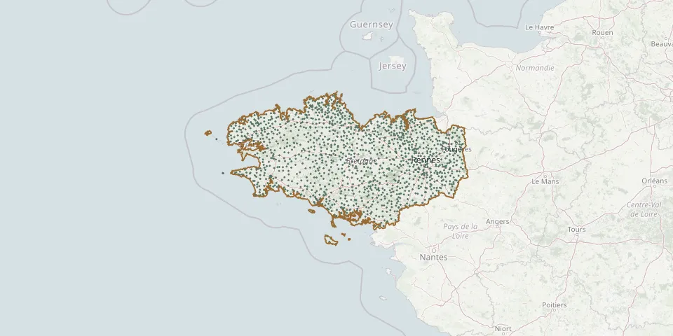 © OpenStreetMap
- Chatillon CemeteryGPS coordinates: 48.22485° N, 1.17613° W
- Chaumeré Village CemeteryGPS coordinates: 48.04121° N, 1.42310° W
- Chauvigné CemeteryGPS coordinates: 48.37920° N, 1.46281° W
- Chavagne CemeteryGPS coordinates: 48.05192° N, 1.79009° W
- Chelun CemeteryGPS coordinates: 47.85513° N, 1.22538° W
- Cherrueix CemeteryGPS coordinates: 48.60546° N, 1.71976° W
- Chevaigné CemeteryGPS coordinates: 48.21006° N, 1.62902° W
- Cintré CemeteryGPS coordinates: 48.10672° N, 1.87673° W
- Clayes CemeteryGPS coordinates: 48.17838° N, 1.85270° W
- Cléden-Cap-Sizun CemeteryGPS coordinates: 48.04774° N, 4.65018° W
- Cléden-Poher CemeteryGPS coordinates: 48.23346° N, 3.66689° W
- Cléder CemeteryGPS coordinates: 48.66334° N, 4.10522° W
- Cléguer CemeteryGPS coordinates: 47.85173° N, 3.38611° W
- Cléguérec CemeteryGPS coordinates: 48.12639° N, 3.06380° W
- Clohars-Carnoët CemeteryGPS coordinates: 47.79903° N, 3.58581° W
- Clohars-Fouesnant CemeteryGPS coordinates: 47.90001° N, 4.06812° W
- Cloître-Pleyben CemeteryGPS coordinates: 48.25973° N, 3.89388° W
- Cloître-Saint-Thégonnec CemeteryGPS coordinates: 48.48109° N, 3.79465° W
- Coadout CemeteryGPS coordinates: 48.51702° N, 3.18945° W
- Coatascorn CemeteryGPS coordinates: 48.67415° N, 3.25125° W
- Coat-Méal CemeteryGPS coordinates: 48.50873° N, 4.54116° W
- Coatréven CemeteryGPS coordinates: 48.76862° N, 3.34365° W
- Coësmes CemeteryGPS coordinates: 47.88315° N, 1.43798° W
- Coët-Bugat CemeteryGPS coordinates: 47.90133° N, 2.57518° W
- Coëtlogon CemeteryGPS coordinates: 48.14093° N, 2.54062° W
- Coëtmieux CemeteryGPS coordinates: 48.48931° N, 2.59998° W
- Coglès CemeteryGPS coordinates: 48.45891° N, 1.35996° W
- Cohiniac CemeteryGPS coordinates: 48.46207° N, 2.95022° W
- Collinée Old CemeteryGPS coordinates: 48.30177° N, 2.52115° W
- Collorec CemeteryGPS coordinates: 48.28443° N, 3.77670° W