
Grand Est
6,234 known cemeteries in Grand Est, France.
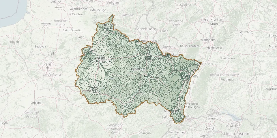 © OpenStreetMap
- Lay-Saint-Christophe CemeteryGPS coordinates: 48.74665° N, 6.20556° E
- Lay-Saint-Remy CemeteryGPS coordinates: 48.68111° N, 5.76423° E
- Lebeuville CemeteryGPS coordinates: 48.43413° N, 6.24441° E
- L'écaille CemeteryGPS coordinates: 49.41709° N, 4.21142° E
- Lecey CemeteryGPS coordinates: 47.86296° N, 5.43877° E
- L'Échelle CemeteryGPS coordinates: 49.79743° N, 4.47988° E
- L'Échelle-le-Franc CemeteryGPS coordinates: 48.89055° N, 3.57003° E
- Lécourt CemeteryGPS coordinates: 48.01453° N, 5.56479° E
- Le Fahrschollen Communal CemeteryGPS coordinates: 48.31691° N, 7.70900° E
- Leffincourt CemeteryGPS coordinates: 49.38910° N, 4.54653° E
- Leffonds CemeteryGPS coordinates: 47.96999° N, 5.16495° E
- L'Eglise ParoissialeGPS coordinates: 47.56271° N, 7.14762° E
- Le Grand Rulut Cemetery, La VilletteGPS coordinates: 49.78517° N, 4.70251° E
- Le Grasberg German Military CemeteryGPS coordinates: 48.21244° N, 7.35330° E
- Le Hohwald Cemetery, rue du LouisentalGPS coordinates: 48.40619° N, 7.32850° E
- Leimbach CemeteryGPS coordinates: 47.79452° N, 7.09451° E
- Leintrey CemeteryGPS coordinates: 48.62592° N, 6.73762° E
- Lelling CemeteryGPS coordinates: 49.03981° N, 6.70808° E
- Lemainville CemeteryGPS coordinates: 48.50713° N, 6.20323° E
- Lembach Cemetery, 17 Rue de WingenGPS coordinates: 49.00591° N, 7.79200° E
- Lemberg Communal CemeteryGPS coordinates: 49.00315° N, 7.38110° E
- Leménil-Mitry CemeteryGPS coordinates: 48.45430° N, 6.25240° E
- Le Ménil Municipal CemeteryGPS coordinates: 47.90937° N, 6.78517° E
- Le Mesnil-lès-Hurlus Old CemeteryGPS coordinates: 49.17700° N, 4.65639° E
- Lemmecourt CemeteryGPS coordinates: 48.26205° N, 5.73723° E
- Lemmes CemeteryGPS coordinates: 49.06521° N, 5.28328° E
- Lemoncourt CemeteryGPS coordinates: 48.86612° N, 6.39300° E
- Lemud CemeteryGPS coordinates: 49.03719° N, 6.36376° E
- Lengelsheim CemeteryGPS coordinates: 49.10797° N, 7.40846° E
- Lenharrée CemeteryGPS coordinates: 48.77612° N, 4.11582° E