
Grand Est
6,234 known cemeteries in Grand Est, France.
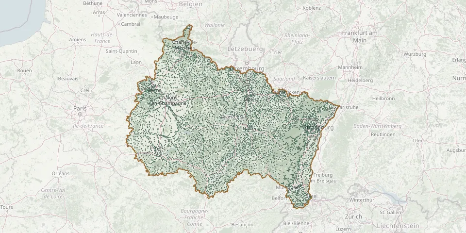 © OpenStreetMap
- Queudes CemeteryGPS coordinates: 48.66016° N, 3.75770° E
- Quincy-Landzécourt CemeteryGPS coordinates: 49.49690° N, 5.29485° E
- Rabenbühl Former German Military CemeteryGPS coordinates: 48.15698° N, 7.13715° E
- Racécourt CemeteryGPS coordinates: 48.25965° N, 6.18990° E
- Rachecourt-sur-Marne CemeteryGPS coordinates: 48.52659° N, 5.09972° E
- Rachecourt-Suzémont CemeteryGPS coordinates: 48.45600° N, 4.96489° E
- Racines CemeteryGPS coordinates: 48.05311° N, 3.83693° E
- Racrange CemeteryGPS coordinates: 48.92044° N, 6.67195° E
- Radonvilliers CemeteryGPS coordinates: 48.35978° N, 4.50549° E
- Raedersdorf CemeteryGPS coordinates: 47.47473° N, 7.36736° E
- Raedersheim CemeteryGPS coordinates: 47.88682° N, 7.28542° E
- Rahling Communal CemeteryGPS coordinates: 48.98838° N, 7.21328° E
- Raillicourt CemeteryGPS coordinates: 49.65020° N, 4.58394° E
- Rainville CemeteryGPS coordinates: 48.36074° N, 5.88619° E
- Raival CemeteryGPS coordinates: 48.87521° N, 5.26312° E
- Rambervillers CemeteryGPS coordinates: 48.34470° N, 6.64271° E
- Rambucourt CemeteryGPS coordinates: 48.84633° N, 5.75571° E
- Ramerupt CemeteryGPS coordinates: 48.51933° N, 4.29323° E
- Ramerupt Cemetery (Rue grande rue Romaines)GPS coordinates: 48.51442° N, 4.31731° E
- Rammersmatt CemeteryGPS coordinates: 47.78916° N, 7.06881° E
- Ramonchamp CemeteryGPS coordinates: 47.88997° N, 6.73835° E
- Rampont Cemetery, Les Souhesmes-RampontGPS coordinates: 49.10320° N, 5.22010° E
- Rancennes CemeteryGPS coordinates: 50.11230° N, 4.82113° E
- Rances CemeteryGPS coordinates: 48.46672° N, 4.54536° E
- Rançonnières CemeteryGPS coordinates: 47.93548° N, 5.55812° E
- Rancourt CemeteryGPS coordinates: 48.22177° N, 6.10770° E
- Rancourt-sur-Ornain CemeteryGPS coordinates: 48.82719° N, 4.91020° E
- Rangecourt CemeteryGPS coordinates: 48.04464° N, 5.48883° E
- Rangen CemeteryGPS coordinates: 48.66487° N, 7.47653° E
- Ranguevaux CemeteryGPS coordinates: 49.31157° N, 6.06130° E