
Grand Est
6,234 known cemeteries in Grand Est, France.
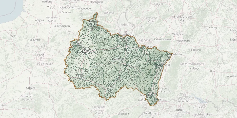 © OpenStreetMap
- Rodern CemeteryGPS coordinates: 48.22544° N, 7.35413° E
- Rœschwoog CemeteryGPS coordinates: 48.82542° N, 8.04042° E
- Rogéville CemeteryGPS coordinates: 48.82225° N, 5.97916° E
- Roggenhouse CemeteryGPS coordinates: 47.89058° N, 7.47066° E
- Rohrbach-lès-Bitche CemeteryGPS coordinates: 49.03998° N, 7.26935° E
- Rohr CemeteryGPS coordinates: 48.69587° N, 7.54587° E
- Rohrwiller CemeteryGPS coordinates: 48.75943° N, 7.90684° E
- Roizy CemeteryGPS coordinates: 49.42636° N, 4.17733° E
- Rolampont CemeteryGPS coordinates: 47.95092° N, 5.28481° E
- Rolbing CemeteryGPS coordinates: 49.17280° N, 7.43930° E
- Rollainville CemeteryGPS coordinates: 48.36075° N, 5.74382° E
- Romagne-sous-les-Côtes CemeteryGPS coordinates: 49.32243° N, 5.47416° E
- Romagne-sous-les-Côtes German Military CemeteryGPS coordinates: 49.32248° N, 5.47541° E
- Romagne-sous-Montfaucon CemeteryGPS coordinates: 49.33410° N, 5.07975° E
- Romagne-sous-Montfaucon German Military CemeteryGPS coordinates: 49.33403° N, 5.08124° E
- Romagny CemeteryGPS coordinates: 47.60999° N, 7.06487° E
- Romain-aux-Bois CemeteryGPS coordinates: 48.08509° N, 5.71819° E
- Romain CemeteryGPS coordinates: 49.33225° N, 3.77254° E
- Romain ChurchyardGPS coordinates: 49.33084° N, 3.76909° E
- Romain-sur-Meuse CemeteryGPS coordinates: 48.17281° N, 5.54050° E
- Romanswiller CemeteryGPS coordinates: 48.64500° N, 7.41320° E
- Romanswiller Jewish CemeteryGPS coordinates: 48.64643° N, 7.41158° E
- Rombach-le-Franc CemeteryGPS coordinates: 48.28146° N, 7.26286° E
- Rombas CemeteryGPS coordinates: 49.25281° N, 6.09129° E
- Romelfing CemeteryGPS coordinates: 48.83447° N, 7.02364° E
- Romelfing ChurchyardGPS coordinates: 48.83171° N, 7.02504° E
- Romery CemeteryGPS coordinates: 49.09805° N, 3.91477° E
- Romigny CemeteryGPS coordinates: 49.17318° N, 3.77042° E
- Romilly-sur-Seine Cemetery (avenue Jean Jaurès)GPS coordinates: 48.51570° N, 3.71350° E
- Romont CemeteryGPS coordinates: 48.35811° N, 6.58423° E