
Grand Est
6,234 known cemeteries in Grand Est, France.
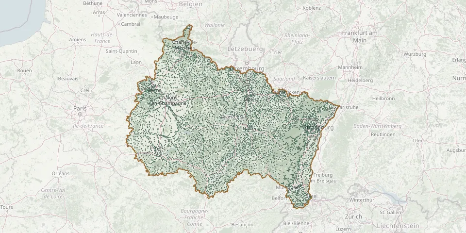 © OpenStreetMap
- Westhalten CemeteryGPS coordinates: 47.95960° N, 7.26059° E
- Westhoffen CemeteryGPS coordinates: 48.60440° N, 7.44795° E
- Westhoffen Cemetery (rue Westerend)GPS coordinates: 48.60428° N, 7.43683° E
- Westhouse CemeteryGPS coordinates: 48.39365° N, 7.58851° E
- Westhouse-Marmoutier CemeteryGPS coordinates: 48.68693° N, 7.45103° E
- Wettolsheim CemeteryGPS coordinates: 48.06281° N, 7.30657° E
- Wettstein French Military Cemetery (1914-1918)GPS coordinates: 48.08856° N, 7.11796° E
- Weyer CemeteryGPS coordinates: 48.85579° N, 7.16515° E
- Weyersheim CemeteryGPS coordinates: 48.71819° N, 7.80184° E
- Weyersheim New CemeteryGPS coordinates: 48.72053° N, 7.79821° E
- Wickerschwihr CemeteryGPS coordinates: 48.10684° N, 7.43819° E
- Wickersheim-Wilshausen CemeteryGPS coordinates: 48.78163° N, 7.53720° E
- Widensolen CemeteryGPS coordinates: 48.06589° N, 7.48078° E
- Wiesviller CemeteryGPS coordinates: 49.08137° N, 7.16718° E
- Wignicourt CemeteryGPS coordinates: 49.57866° N, 4.57933° E
- Wihr-au-Val CemeteryGPS coordinates: 48.05427° N, 7.20462° E
- Wihr-en-Plaine CemeteryGPS coordinates: 48.08432° N, 7.41399° E
- Wildenstein CemeteryGPS coordinates: 47.97635° N, 6.96050° E
- Wildersbach CemeteryGPS coordinates: 48.43792° N, 7.22453° E
- Willer ChurchyardGPS coordinates: 47.58619° N, 7.31959° E
- Willeroncourt CemeteryGPS coordinates: 48.71651° N, 5.37016° E
- Willer-sur-Thur CemeteryGPS coordinates: 47.84361° N, 7.07154° E
- Willerwald CemeteryGPS coordinates: 49.02569° N, 7.03511° E
- Willgottheim CemeteryGPS coordinates: 48.68080° N, 7.50940° E
- Williers CemeteryGPS coordinates: 49.66930° N, 5.30660° E
- Wilwisheim CemeteryGPS coordinates: 48.74791° N, 7.50875° E
- Wimmenau CemeteryGPS coordinates: 48.91240° N, 7.41452° E
- Windstein CemeteryGPS coordinates: 48.99368° N, 7.68342° E
- Wingen CemeteryGPS coordinates: 49.02366° N, 7.81353° E
- Wingen-sur-Moder CemeteryGPS coordinates: 48.91650° N, 7.37874° E