
Normandy
3,345 known cemeteries in Normandy, France.
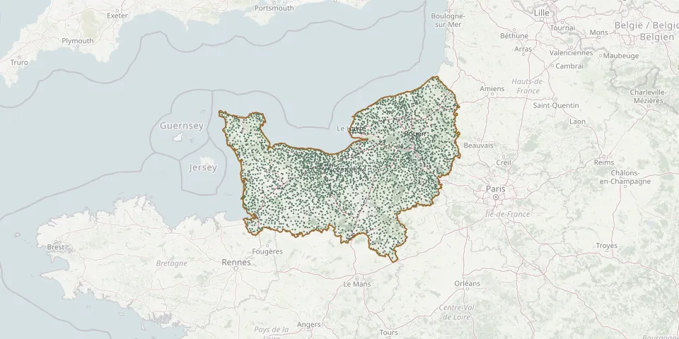 © OpenStreetMap
- Romagny CemeteryGPS coordinates: 48.63973° N, 0.96599° W
- Roman Cemetery, RomanGPS coordinates: 48.84665° N, 1.04623° E
- Romilly-la-Puthenaye CemeteryGPS coordinates: 49.00437° N, 0.85102° E
- Romilly-sur-Andelle CemeteryGPS coordinates: 49.33679° N, 1.25729° E
- Rônai CemeteryGPS coordinates: 48.81246° N, 0.13037° W
- Roncenay-Authenay CemeteryGPS coordinates: 48.85897° N, 1.04630° E
- Roncey CemeteryGPS coordinates: 48.98937° N, 1.32981° W
- Roncherolles-en-Bray CemeteryGPS coordinates: 49.61498° N, 1.45361° E
- Ronfeugerai CemeteryGPS coordinates: 48.78128° N, 0.47323° W
- Ronthon CemeteryGPS coordinates: 48.72960° N, 1.48240° W
- Rosay-sur-Lieure CemeteryGPS coordinates: 49.36475° N, 1.42936° E
- Rosel ChurchyardGPS coordinates: 49.22725° N, 0.45980° W
- Rosel Municipal CemeteryGPS coordinates: 49.22168° N, 0.46295° W
- Rotours CemeteryGPS coordinates: 48.77921° N, 0.26324° W
- Rots CemeteryGPS coordinates: 49.21198° N, 0.47390° W
- Roucamps CemeteryGPS coordinates: 48.99036° N, 0.62364° W
- Rouellé CemeteryGPS coordinates: 48.60100° N, 0.72608° W
- Rouelles CemeteryGPS coordinates: 49.52434° N, 0.16826° E
- Rouen German Military CemeteryGPS coordinates: 49.44798° N, 1.12379° E
- Rouen North CemeteryGPS coordinates: 49.44828° N, 1.12132° E
- Rouffigny CemeteryGPS coordinates: 48.80335° N, 1.25145° W
- Rougemontier Saint-Martin ChurchyardGPS coordinates: 49.35918° N, 0.72024° E
- Rougemontiers CemeteryGPS coordinates: 49.38026° N, 0.74336° E
- Rouge-Perriers CemeteryGPS coordinates: 49.14636° N, 0.83433° E
- Rouges Terres CemeteryGPS coordinates: 49.48774° N, 1.13306° E
- Roullours CemeteryGPS coordinates: 48.83222° N, 0.83805° W
- Roumare CemeteryGPS coordinates: 49.51045° N, 0.97620° E
- Rouperroux CemeteryGPS coordinates: 48.54906° N, 0.08997° W
- Route des Andelys Cemetery, Gournay-en-BrayGPS coordinates: 49.47315° N, 1.71498° E
- Routes CemeteryGPS coordinates: 49.73206° N, 0.74936° E