
Baden-Württemberg
3,860 known cemeteries in Baden-Württemberg, Germany.
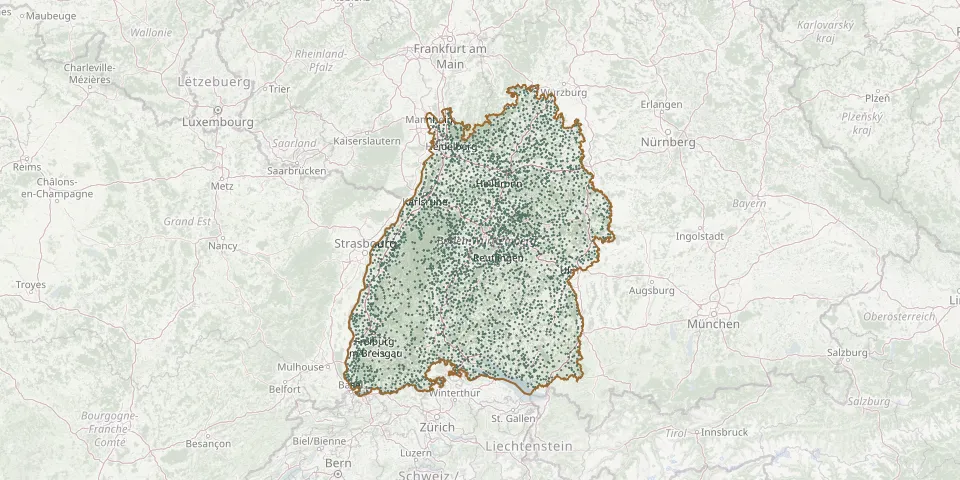 © OpenStreetMap
- Sontheim CemeteryGPS coordinates: 48.55060° N, 10.28835° E
- Sontheim Jewish CemeteryGPS coordinates: 49.11142° N, 9.18041° E
- Sontheim Mountain CemeteryGPS coordinates: 48.44422° N, 9.66094° E
- Spaichingen CemeteryGPS coordinates: 48.07244° N, 8.73279° E
- Sparwiesen New CemeteryGPS coordinates: 48.68259° N, 9.58532° E
- Sparwiesen Old CemeteryGPS coordinates: 48.68016° N, 9.58443° E
- Spechbach CemeteryGPS coordinates: 49.34640° N, 8.88238° E
- Spessart CemeteryGPS coordinates: 48.91701° N, 8.43775° E
- Spiegelberg CemeteryGPS coordinates: 49.03315° N, 9.43681° E
- Spiegelberg CemeteryGPS coordinates: 49.03865° N, 9.44361° E
- Spielbach CemeteryGPS coordinates: 49.38276° N, 10.06873° E
- Spielberg CemeteryGPS coordinates: 48.56258° N, 8.59331° E
- Spielberg CemeteryGPS coordinates: 49.01882° N, 8.99640° E
- Spielberg CemeteryGPS coordinates: 48.89710° N, 8.47360° E
- Spielplatz am CemeteryGPS coordinates: 48.79231° N, 9.93906° E
- Spöck CemeteryGPS coordinates: 49.10861° N, 8.51238° E
- Spraitbach CemeteryGPS coordinates: 48.88061° N, 9.76440° E
- Sprantal CemeteryGPS coordinates: 49.00590° N, 8.68220° E
- Sprollenhaus CemeteryGPS coordinates: 48.69754° N, 8.50495° E
- Stachenhausen CemeteryGPS coordinates: 49.33185° N, 9.70898° E
- Stadelhofen CemeteryGPS coordinates: 48.56144° N, 8.04085° E
- Stafflangen CemeteryGPS coordinates: 48.09269° N, 9.70873° E
- Staffort CemeteryGPS coordinates: 49.08935° N, 8.51313° E
- Staig CemeteryGPS coordinates: 48.29930° N, 9.98610° E
- Stalter Cemetery, Titisee-NeustadtGPS coordinates: 47.90680° N, 8.23117° E
- Stammheim CemeteryGPS coordinates: 48.69574° N, 8.76927° E
- Stammheim CemeteryGPS coordinates: 48.85043° N, 9.16012° E
- Standorf CemeteryGPS coordinates: 49.44315° N, 10.00193° E
- St. Andreas Historic CemeteryGPS coordinates: 48.93982° N, 8.83896° E
- Starzeln CemeteryGPS coordinates: 48.30674° N, 9.06748° E