
Baden-Württemberg
3,860 known cemeteries in Baden-Württemberg, Germany.
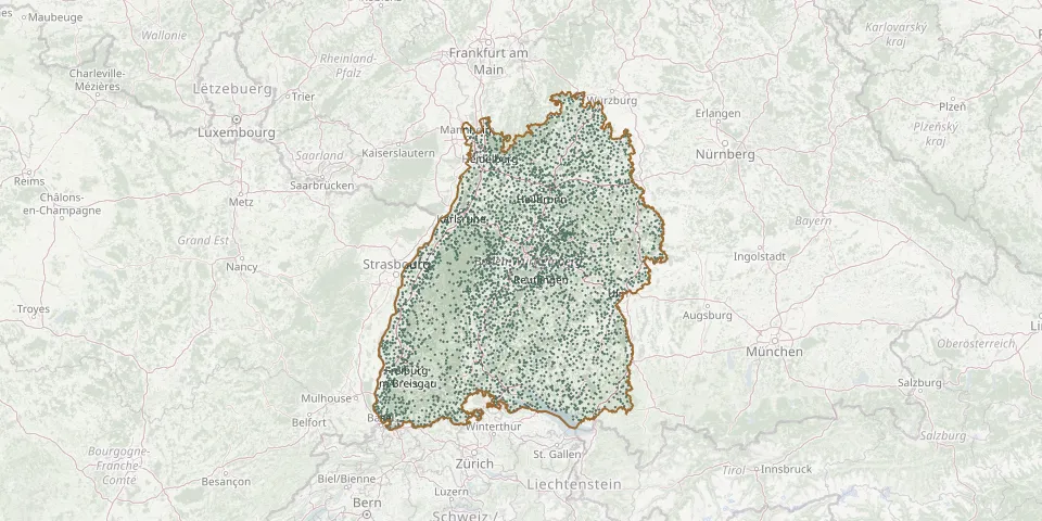 © OpenStreetMap
- Biberach Evangelical CemeteryGPS coordinates: 48.10143° N, 9.79732° E
- Neckargemünd CemeteryGPS coordinates: 49.39178° N, 8.79451° E
- Neipperg CemeteryGPS coordinates: 49.10549° N, 9.04816° E
- Niederzell CemeteryGPS coordinates: 47.70695° N, 9.04365° E
- Schwieberdingen CemeteryGPS coordinates: 48.87966° N, 9.07630° E
- Bockschaft CemeteryGPS coordinates: 49.20542° N, 8.96362° E
- Büsingen CemeteryGPS coordinates: 47.69824° N, 8.70310° E
- Hausen an der Aach CemeteryGPS coordinates: 47.79559° N, 8.84109° E
- Schnittlingen CemeteryGPS coordinates: 48.67827° N, 9.87772° E
- Zeutern CemeteryGPS coordinates: 49.17386° N, 8.67754° E
- Bad Wurzach CemeteryGPS coordinates: 47.90613° N, 9.90056° E
- Brunnadern CemeteryGPS coordinates: 47.79115° N, 8.38413° E
- Gartenstadt Woodland CemeteryGPS coordinates: 49.53840° N, 8.49672° E
- Horb CemeteryGPS coordinates: 48.44720° N, 8.69570° E
- Lörrach Muslim CemeteryGPS coordinates: 47.61953° N, 7.67188° E
- Stiftskirche LahrGPS coordinates: 48.33880° N, 7.87620° E
- Ulm Jewish Cemetery SectionGPS coordinates: 48.41330° N, 9.98785° E
- Gamburg CemeteryGPS coordinates: 49.69821° N, 9.60193° E
- Gamburg Honour Grove for the Fallen of Both World WarsGPS coordinates: 49.69772° N, 9.60098° E
- Geradstetten New CemeteryGPS coordinates: 48.81558° N, 9.44273° E
- Gültstein Old CemeteryGPS coordinates: 48.57725° N, 8.87818° E
- Haueneberstein CemeteryGPS coordinates: 48.80568° N, 8.22397° E
- Oberwangen CemeteryGPS coordinates: 47.77669° N, 8.37644° E
- Weitenau CemeteryGPS coordinates: 47.68250° N, 7.77596° E
- Welschensteinach CemeteryGPS coordinates: 48.27380° N, 8.01787° E
- Baltringen CemeteryGPS coordinates: 48.17504° N, 9.86454° E
- Denkendorf CemeteryGPS coordinates: 48.69284° N, 9.31410° E
- Ebersberg CemeteryGPS coordinates: 48.93630° N, 9.53303° E
- FriedWald LenzkirchGPS coordinates: 47.84293° N, 8.23505° E
- Geisingen CemeteryGPS coordinates: 47.92199° N, 8.65162° E