
Baden-Württemberg
3,860 known cemeteries in Baden-Württemberg, Germany.
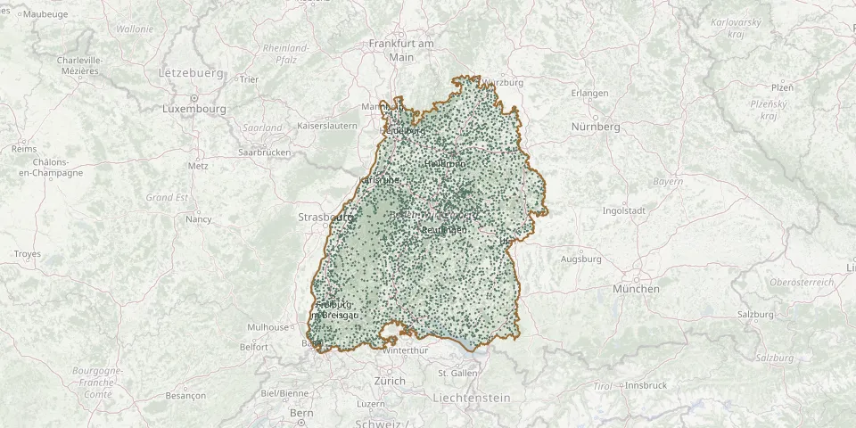 © OpenStreetMap
- Kaisersbach CemeteryGPS coordinates: 48.92865° N, 9.63658° E
- Kälberbronn CemeteryGPS coordinates: 48.53438° N, 8.49720° E
- Kälbertshausen CemeteryGPS coordinates: 49.32129° N, 9.06655° E
- Kaltbrunn CemeteryGPS coordinates: 48.34953° N, 8.34988° E
- Kaltenbach CemeteryGPS coordinates: 47.75362° N, 7.72844° E
- Kandern Catholic CemeteryGPS coordinates: 47.71640° N, 7.66450° E
- Kanzach CemeteryGPS coordinates: 48.08017° N, 9.55624° E
- Kapfenhardt CemeteryGPS coordinates: 48.80709° N, 8.67354° E
- Kappelberg Cemetery, Bad WildbadGPS coordinates: 48.75260° N, 8.55182° E
- Kappel CemeteryGPS coordinates: 47.77164° N, 9.44965° E
- Kappel CemeteryGPS coordinates: 47.87352° N, 8.24120° E
- Kappel CemeteryGPS coordinates: 48.11172° N, 8.49742° E
- Kappel CemeteryGPS coordinates: 48.28960° N, 7.74831° E
- Kappel CemeteryGPS coordinates: 47.96623° N, 7.90832° E
- Kappelrodeck CemeteryGPS coordinates: 48.58948° N, 8.10920° E
- Kappelwindeck CemeteryGPS coordinates: 48.69003° N, 8.14846° E
- Kappishäusern CemeteryGPS coordinates: 48.55014° N, 9.32403° E
- Karlsdorf CemeteryGPS coordinates: 49.13958° N, 8.53614° E
- Karlsruhe Old Jewish CemeteryGPS coordinates: 49.01497° N, 8.49860° E
- Karlsruhe Orthodox Jewish CemeteryGPS coordinates: 49.01447° N, 8.43073° E
- Karsau Woodland CemeteryGPS coordinates: 47.59272° N, 7.80964° E
- Karsee CemeteryGPS coordinates: 47.75048° N, 9.80554° E
- Katzental CemeteryGPS coordinates: 49.37406° N, 9.26355° E
- Kau CemeteryGPS coordinates: 47.66990° N, 9.56312° E
- Kehl CemeteryGPS coordinates: 48.56929° N, 7.82773° E
- Kehl War CemeteryGPS coordinates: 48.57353° N, 7.82379° E
- KeltengräberGPS coordinates: 49.67237° N, 9.64156° E
- Kembach CemeteryGPS coordinates: 49.74168° N, 9.62654° E
- Kentheim CemeteryGPS coordinates: 48.69513° N, 8.73067° E
- Kenzingen CemeteryGPS coordinates: 48.17234° N, 7.77506° E