
Baden-Württemberg
3,860 known cemeteries in Baden-Württemberg, Germany.
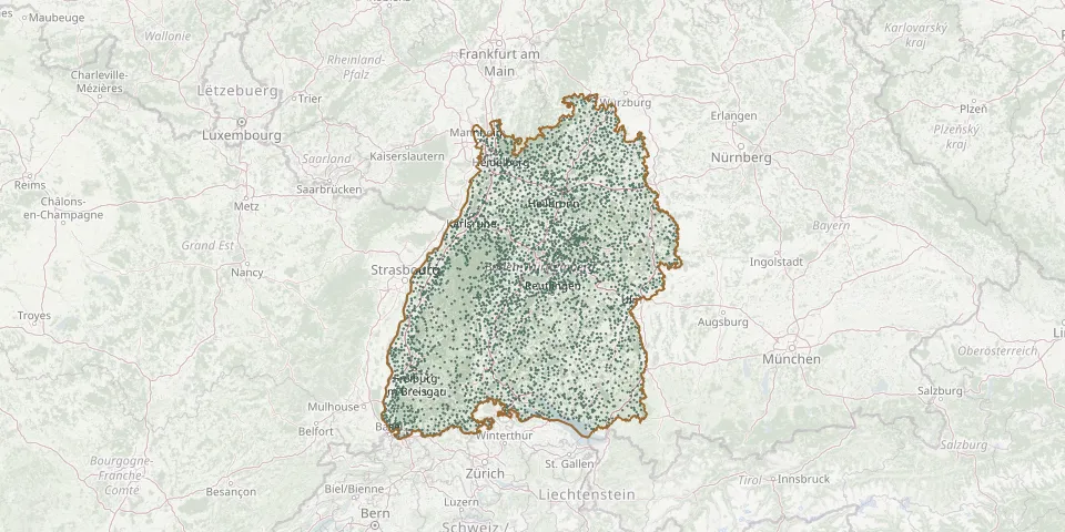 © OpenStreetMap
- Klosterreichenbach Old CemeteryGPS coordinates: 48.52280° N, 8.39812° E
- Kloster St. Peter auf dem SchwarzwaldGPS coordinates: 48.01667° N, 8.03250° E
- Kluftern CemeteryGPS coordinates: 47.69565° N, 9.39811° E
- Kniebis CemeteryGPS coordinates: 48.47244° N, 8.31458° E
- Knittlingen CemeteryGPS coordinates: 49.02760° N, 8.76040° E
- Kochendorf Jewish CemeteryGPS coordinates: 49.22039° N, 9.21182° E
- Kochendorf Old CemeteryGPS coordinates: 49.22139° N, 9.21428° E
- Kochersteinsfeld CemeteryGPS coordinates: 49.24236° N, 9.40813° E
- Kocherstetten CemeteryGPS coordinates: 49.26655° N, 9.76234° E
- Kochertürn CemeteryGPS coordinates: 49.24503° N, 9.31320° E
- Kohlberg CemeteryGPS coordinates: 48.56810° N, 9.33012° E
- Kolbingen CemeteryGPS coordinates: 48.05310° N, 8.89331° E
- Kollmarsreute CemeteryGPS coordinates: 48.10347° N, 7.88388° E
- Kollnau CemeteryGPS coordinates: 48.10586° N, 7.96448° E
- Kommingen CemeteryGPS coordinates: 47.81810° N, 8.61052° E
- Köndringen CemeteryGPS coordinates: 48.14249° N, 7.80717° E
- Königheim CemeteryGPS coordinates: 49.61697° N, 9.59059° E
- Königheim Jewish CemeteryGPS coordinates: 49.61787° N, 9.60239° E
- Königsbach CemeteryGPS coordinates: 48.96465° N, 8.61576° E
- Königsbach-Stein Old Jewish CemeteryGPS coordinates: 48.95702° N, 8.61334° E
- Königschaffhausen CemeteryGPS coordinates: 48.13704° N, 7.65303° E
- Königseggwald CemeteryGPS coordinates: 47.92488° N, 9.42149° E
- Königsfeld im Schwarzwald Historic CemeteryGPS coordinates: 48.14302° N, 8.42598° E
- Königsheim CemeteryGPS coordinates: 48.09971° N, 8.86883° E
- Königshofen CemeteryGPS coordinates: 49.54928° N, 9.73600° E
- Konstanz Main CemeteryGPS coordinates: 47.67972° N, 9.17358° E
- Korb Old CemeteryGPS coordinates: 48.84514° N, 9.35978° E
- Kork CemeteryGPS coordinates: 48.56875° N, 7.86766° E
- Korntal CemeteryGPS coordinates: 48.83339° N, 9.12307° E
- Korntal New CemeteryGPS coordinates: 48.83315° N, 9.12897° E