
Baden-Württemberg
3,860 known cemeteries in Baden-Württemberg, Germany.
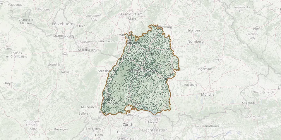 © OpenStreetMap
- Raidwangen CemeteryGPS coordinates: 48.60653° N, 9.30344° E
- Raitbach CemeteryGPS coordinates: 47.67984° N, 7.86435° E
- Raithaslach CemeteryGPS coordinates: 47.88384° N, 8.96307° E
- Rammersweier CemeteryGPS coordinates: 48.48242° N, 7.97192° E
- Randegg CemeteryGPS coordinates: 47.72217° N, 8.76048° E
- Randegg Jewish CemeteryGPS coordinates: 47.72500° N, 8.73733° E
- Rangendingen CemeteryGPS coordinates: 48.37998° N, 8.88472° E
- Rappach CemeteryGPS coordinates: 49.17115° N, 9.43040° E
- Rappertshofen Former CemeteryGPS coordinates: 48.52307° N, 9.20596° E
- Rastatt Jewish CemeteryGPS coordinates: 48.86268° N, 8.21590° E
- Rastatt Old CemeteryGPS coordinates: 48.86120° N, 8.20680° E
- Rastatt Town CemeteryGPS coordinates: 48.86370° N, 8.21360° E
- Rastatt Woodland CemeteryGPS coordinates: 48.87124° N, 8.22452° E
- Rast CemeteryGPS coordinates: 47.93959° N, 9.12651° E
- Ratshausen CemeteryGPS coordinates: 48.19309° N, 8.79922° E
- Rattenharz CemeteryGPS coordinates: 48.77981° N, 9.66094° E
- Ratzenried CemeteryGPS coordinates: 47.72387° N, 9.89954° E
- Rauenberg CemeteryGPS coordinates: 49.26481° N, 8.70183° E
- Rauenberg CemeteryGPS coordinates: 49.73675° N, 9.38627° E
- Rauental CemeteryGPS coordinates: 48.85945° N, 8.25176° E
- Rechberg CemeteryGPS coordinates: 48.75678° N, 9.79060° E
- Rechberg CemeteryGPS coordinates: 47.65304° N, 8.40475° E
- Rechberghausen CemeteryGPS coordinates: 48.73338° N, 9.63383° E
- Rechenberg CemeteryGPS coordinates: 49.05317° N, 10.14910° E
- Regglisweiler CemeteryGPS coordinates: 48.24333° N, 10.05597° E
- Reichartshausen CemeteryGPS coordinates: 49.35449° N, 8.94314° E
- Reichenbach CemeteryGPS coordinates: 48.13084° N, 8.84300° E
- Reichenbach CemeteryGPS coordinates: 48.71004° N, 9.79811° E
- Reichenbach CemeteryGPS coordinates: 48.71495° N, 9.46218° E
- Reichenbach CemeteryGPS coordinates: 48.15628° N, 7.92403° E