
Saarland
437 known cemeteries in Saarland, Germany.
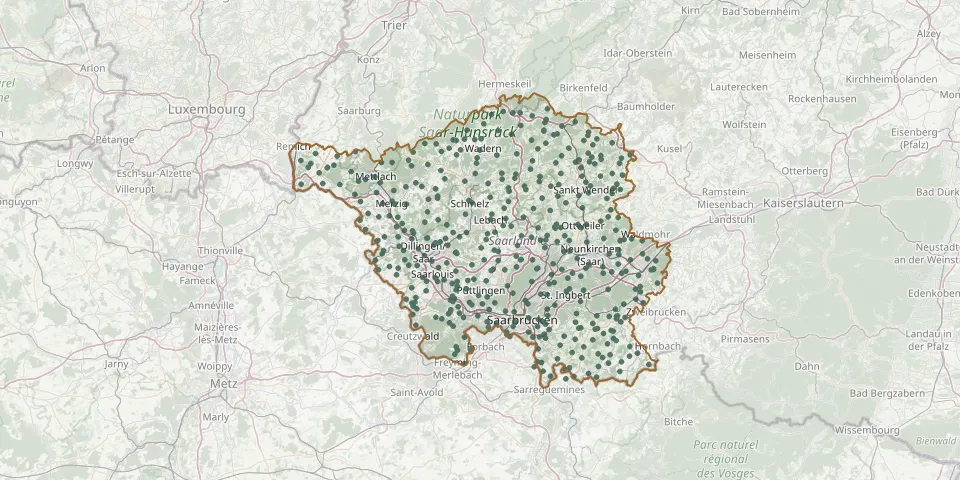 © OpenStreetMap
- Sinz CemeteryGPS coordinates: 49.53169° N, 6.42832° E
- Sitterswald CemeteryGPS coordinates: 49.13311° N, 7.07356° E
- Sitzerath CemeteryGPS coordinates: 49.60145° N, 6.91171° E
- Sötern CemeteryGPS coordinates: 49.59206° N, 7.06136° E
- Sötern Jewish CemeteryGPS coordinates: 49.58710° N, 7.05735° E
- Sotzweiler CemeteryGPS coordinates: 49.46743° N, 7.00552° E
- Spiesen-Elversberg Main CemeteryGPS coordinates: 49.30900° N, 7.12093° E
- Sprengen CemeteryGPS coordinates: 49.30486° N, 6.84676° E
- Spurker CemeteryGPS coordinates: 49.26691° N, 6.80550° E
- St. Barbara CemeteryGPS coordinates: 49.33209° N, 6.68409° E
- Steinbach CemeteryGPS coordinates: 49.41073° N, 7.21168° E
- Steinbach CemeteryGPS coordinates: 49.46476° N, 6.96012° E
- Steinberg CemeteryGPS coordinates: 49.57357° N, 6.84462° E
- Steinberg-Deckenhardt CemeteryGPS coordinates: 49.54117° N, 7.12372° E
- Stennweiler CemeteryGPS coordinates: 49.38452° N, 7.11272° E
- St. Johann CemeteryGPS coordinates: 49.34972° N, 6.72775° E
- St. Martin Church Cemetery, Berus - ÜberherrnGPS coordinates: 49.26590° N, 6.70040° E
- St. Nikolaus CemeteryGPS coordinates: 49.35860° N, 6.61482° E
- Stumm Family Cemetery, SaarbrückenGPS coordinates: 49.22258° N, 7.03729° E
- St. Wendel Jewish CemeteryGPS coordinates: 49.48032° N, 7.17031° E
- St. Wendel Main CemeteryGPS coordinates: 49.46150° N, 7.17805° E
- Sulzbach CemeteryGPS coordinates: 49.29866° N, 7.06970° E
- Tettingen-Butzdorf CemeteryGPS coordinates: 49.51382° N, 6.41542° E
- Thailen CemeteryGPS coordinates: 49.53825° N, 6.82621° E
- Thalexweiler CemeteryGPS coordinates: 49.44610° N, 6.95803° E
- Theley CemeteryGPS coordinates: 49.50376° N, 7.01876° E
- Tholey Jewish CemeteryGPS coordinates: 49.49066° N, 7.04434° E
- Tholey War CemeteryGPS coordinates: 49.49074° N, 7.04458° E
- Tünsdorf CemeteryGPS coordinates: 49.47650° N, 6.49488° E
- Türkismühle CemeteryGPS coordinates: 49.58060° N, 7.10444° E