
Saarland
437 known cemeteries in Saarland, Germany.
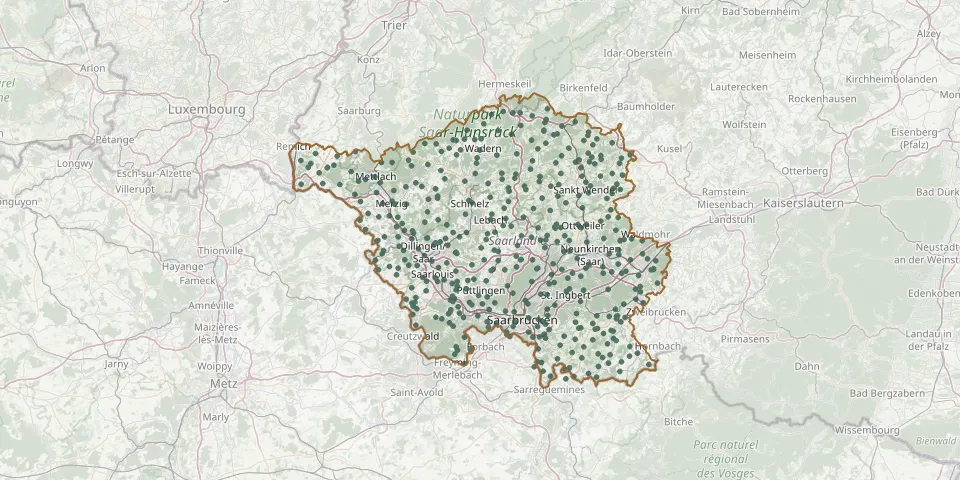 © OpenStreetMap
- Hülzweiler CemeteryGPS coordinates: 49.32129° N, 6.81299° E
- Humes CemeteryGPS coordinates: 49.38473° N, 6.99361° E
- Hüttersdorf CemeteryGPS coordinates: 49.42347° N, 6.83997° E
- Hüttigweiler CemeteryGPS coordinates: 49.38542° N, 7.06431° E
- Ihn CemeteryGPS coordinates: 49.32383° N, 6.60106° E
- Illingen CemeteryGPS coordinates: 49.37719° N, 7.04631° E
- Illingen Jewish CemeteryGPS coordinates: 49.37770° N, 7.06028° E
- Ingweiler CemeteryGPS coordinates: 49.27140° N, 7.30817° E
- Jägersburg CemeteryGPS coordinates: 49.37570° N, 7.32490° E
- Jägersfreude CemeteryGPS coordinates: 49.26293° N, 7.01079° E
- Karcher Family Private Cemetery, BeckingenGPS coordinates: 49.38937° N, 6.69752° E
- Karlsbrunn CemeteryGPS coordinates: 49.17970° N, 6.81784° E
- Karlsbrunn Historic CemeteryGPS coordinates: 49.17257° N, 6.81025° E
- Kastel CemeteryGPS coordinates: 49.56646° N, 6.96641° E
- Kerlingen CemeteryGPS coordinates: 49.31474° N, 6.65073° E
- Keßlingen CemeteryGPS coordinates: 49.51097° N, 6.47862° E
- Kirkel-Neuhäusel CemeteryGPS coordinates: 49.28887° N, 7.23157° E
- Kirrberg CemeteryGPS coordinates: 49.29986° N, 7.36734° E
- Klarenthal CemeteryGPS coordinates: 49.23082° N, 6.89939° E
- Kleinblittersdorf CemeteryGPS coordinates: 49.15882° N, 7.03787° E
- Kleinblittersdorf Jewish CemeteryGPS coordinates: 49.14968° N, 7.02845° E
- Kleinblittersdorf Woodland CemeteryGPS coordinates: 49.15793° N, 7.04869° E
- Kleinottweiler CemeteryGPS coordinates: 49.34196° N, 7.29308° E
- Kohlhof CemeteryGPS coordinates: 49.32044° N, 7.24185° E
- Köllerbach CemeteryGPS coordinates: 49.30413° N, 6.89708° E
- Konfeld CemeteryGPS coordinates: 49.55754° N, 6.83689° E
- Körprich CemeteryGPS coordinates: 49.39077° N, 6.84295° E
- Krughütte CemeteryGPS coordinates: 49.22121° N, 6.90276° E
- Kutzhof CemeteryGPS coordinates: 49.34820° N, 6.97925° E
- Landsweiler CemeteryGPS coordinates: 49.35793° N, 7.12603° E