
Saxony-Anhalt
1,609 known cemeteries in Saxony-Anhalt, Germany.
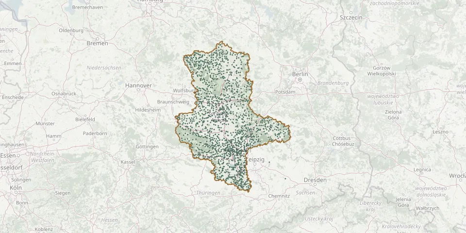 © OpenStreetMap
- Aulosen CemeteryGPS coordinates: 52.99304° N, 11.57807° E
- Aupitz CemeteryGPS coordinates: 51.17477° N, 12.03552° E
- Baars CemeteryGPS coordinates: 52.75427° N, 11.22441° E
- Baasdorf CemeteryGPS coordinates: 51.70745° N, 11.98696° E
- Baben CemeteryGPS coordinates: 52.69597° N, 11.89160° E
- Bad Düben Woodland CemeteryGPS coordinates: 51.61748° N, 12.59553° E
- Bad Dürrenberg Old CemeteryGPS coordinates: 51.29261° N, 12.06650° E
- Badeborn CemeteryGPS coordinates: 51.75949° N, 11.24144° E
- Badel CemeteryGPS coordinates: 52.73441° N, 11.31838° E
- Badeleben CemeteryGPS coordinates: 52.14996° N, 11.12045° E
- Badersleben Catholic CemeteryGPS coordinates: 51.98230° N, 10.88570° E
- Badewitz CemeteryGPS coordinates: 52.02330° N, 12.16248° E
- Bad Kösen CemeteryGPS coordinates: 51.13405° N, 11.72439° E
- Bad Lauchstädt CemeteryGPS coordinates: 51.38831° N, 11.86907° E
- Bad Schmiedeberg CemeteryGPS coordinates: 51.69316° N, 12.73614° E
- Bad Suderode CemeteryGPS coordinates: 51.72948° N, 11.11107° E
- Bahrendorf CemeteryGPS coordinates: 52.00104° N, 11.55474° E
- Balditz New CemeteryGPS coordinates: 51.29144° N, 12.08209° E
- Ballenstedt CemeteryGPS coordinates: 51.71931° N, 11.23892° E
- Ballenstedt Jewish CemeteryGPS coordinates: 51.72708° N, 11.25054° E
- Bandau CemeteryGPS coordinates: 52.67260° N, 11.10617° E
- Barby CemeteryGPS coordinates: 51.96350° N, 11.87980° E
- Barleben CemeteryGPS coordinates: 52.20829° N, 11.62042° E
- Barleben Old CemeteryGPS coordinates: 52.20627° N, 11.61964° E
- Barnebeck CemeteryGPS coordinates: 52.84566° N, 10.92713° E
- Barnstädt CemeteryGPS coordinates: 51.34562° N, 11.64770° E
- Barnstädt Cemetery (St. Kilian)GPS coordinates: 51.34240° N, 11.62895° E
- Battin CemeteryGPS coordinates: 51.76809° N, 12.90371° E
- Baumersroda CemeteryGPS coordinates: 51.26353° N, 11.75707° E
- Bebertal I CemeteryGPS coordinates: 52.23668° N, 11.32120° E