
Saxony
1,500 known cemeteries in Saxony, Germany.
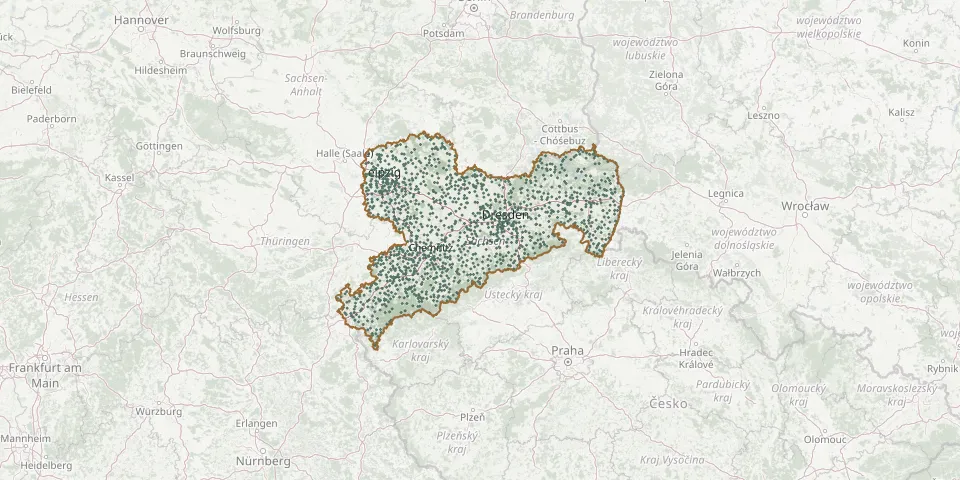 © OpenStreetMap
- Erlbach CemeteryGPS coordinates: 50.31440° N, 12.36252° E
- Erlbach CemeteryGPS coordinates: 50.76405° N, 12.73934° E
- Erzgebirge Woodland CemeteryGPS coordinates: 50.59178° N, 12.73866° E
- Eschdorf CemeteryGPS coordinates: 51.03446° N, 13.94213° E
- Etzdorf CemeteryGPS coordinates: 51.05081° N, 13.18031° E
- Etzoldshain CemeteryGPS coordinates: 51.15988° N, 12.66563° E
- Euba CemeteryGPS coordinates: 50.83256° N, 13.01897° E
- Eula CemeteryGPS coordinates: 51.15095° N, 12.51371° E
- Evangelische Kirche, LaasGPS coordinates: 51.36674° N, 13.14557° E
- Ev. Kirche Ebersbach/Sa.GPS coordinates: 51.00901° N, 14.59846° E
- Ev.-Luth. Kirchgemeinde ReichenbergGPS coordinates: 51.12979° N, 13.67920° E
- Ev. Pfarrkirche ProbsthainGPS coordinates: 51.47069° N, 12.89656° E
- Falkenau CemeteryGPS coordinates: 50.85837° N, 13.11704° E
- Falken CemeteryGPS coordinates: 50.84037° N, 12.68365° E
- Falkenhain Evangelical CemeteryGPS coordinates: 51.39790° N, 12.87260° E
- Falkenstein CemeteryGPS coordinates: 50.48833° N, 12.37980° E
- Firedhof SelbenGPS coordinates: 51.49680° N, 12.36450° E
- Fischbach CemeteryGPS coordinates: 51.08610° N, 14.01752° E
- Flöha-Georgen CemeteryGPS coordinates: 50.86269° N, 13.07351° E
- Flöha-Plaue CemeteryGPS coordinates: 50.84141° N, 13.07121° E
- Flößberg CemeteryGPS coordinates: 51.12534° N, 12.58324° E
- Forchheim CemeteryGPS coordinates: 50.71712° N, 13.27963° E
- Förstgen CemeteryGPS coordinates: 51.29672° N, 14.66113° E
- Frankenau CemeteryGPS coordinates: 50.99193° N, 12.91171° E
- Frankenberg CemeteryGPS coordinates: 50.90110° N, 13.03380° E
- Frankenhain CemeteryGPS coordinates: 51.08219° N, 12.65251° E
- Frankenhausen CemeteryGPS coordinates: 50.84068° N, 12.39126° E
- Frankenstein CemeteryGPS coordinates: 50.90156° N, 13.21212° E
- Frauendorf CemeteryGPS coordinates: 51.07307° N, 12.62788° E
- Frauenhain Historic Woodland CemeteryGPS coordinates: 51.38304° N, 13.46727° E