
Saxony
1,500 known cemeteries in Saxony, Germany.
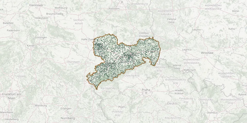 © OpenStreetMap
- Klitten Old Lutheran CemeteryGPS coordinates: 51.35196° N, 14.59880° E
- Klix CemeteryGPS coordinates: 51.26410° N, 14.52332° E
- Klotzsche New CemeteryGPS coordinates: 51.12019° N, 13.77342° E
- Klotzsche Old CemeteryGPS coordinates: 51.11023° N, 13.76450° E
- Knappenrode CemeteryGPS coordinates: 51.40456° N, 14.33252° E
- Knauthain CemeteryGPS coordinates: 51.27483° N, 12.30964° E
- Knautnaundorf CemeteryGPS coordinates: 51.25418° N, 12.26920° E
- Knobelsdorf CemeteryGPS coordinates: 51.08912° N, 13.08473° E
- Köbeln CemeteryGPS coordinates: 51.56988° N, 14.71356° E
- Kobershain CemeteryGPS coordinates: 51.45317° N, 12.87274° E
- Kodersdorf Municipal CemeteryGPS coordinates: 51.22983° N, 14.89276° E
- Köhra CemeteryGPS coordinates: 51.24716° N, 12.56467° E
- Kohren-Sahlis CemeteryGPS coordinates: 51.02020° N, 12.60900° E
- Kollau CemeteryGPS coordinates: 51.42824° N, 12.63861° E
- Kollm CemeteryGPS coordinates: 51.26652° N, 14.73064° E
- Kölsa CemeteryGPS coordinates: 51.47117° N, 12.23170° E
- Königsbrück Prisoner-of-War CemeteryGPS coordinates: 51.29015° N, 13.90295° E
- Königsbrück Town CemeteryGPS coordinates: 51.26338° N, 13.90817° E
- Königsfeld CemeteryGPS coordinates: 51.06277° N, 12.75333° E
- Königshain CemeteryGPS coordinates: 50.97320° N, 12.87793° E
- Königshain War CemeteryGPS coordinates: 51.17998° N, 14.88594° E
- Königstein Fortress CemeteryGPS coordinates: 50.91760° N, 14.05387° E
- Königswalde CemeteryGPS coordinates: 50.74821° N, 12.41269° E
- Königswalde CemeteryGPS coordinates: 50.54670° N, 13.05062° E
- Königswartha CemeteryGPS coordinates: 51.30882° N, 14.33330° E
- Königswartha Old CemeteryGPS coordinates: 51.31017° N, 14.32796° E
- Kosel CemeteryGPS coordinates: 51.35168° N, 14.79296° E
- Koselitz CemeteryGPS coordinates: 51.38040° N, 13.42567° E
- Kössern CemeteryGPS coordinates: 51.18688° N, 12.78537° E
- Köthensdorf CemeteryGPS coordinates: 50.90962° N, 12.86660° E