
Schleswig-Holstein
612 known cemeteries in Schleswig-Holstein, Germany.
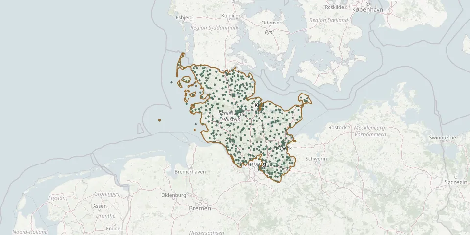 © OpenStreetMap
- Osdorf CemeteryGPS coordinates: 54.42953° N, 10.01449° E
- Osewoldterkoog Dwelling Mound CemeteryGPS coordinates: 54.73044° N, 8.72323° E
- Ostenfeld CemeteryGPS coordinates: 54.31313° N, 9.76015° E
- Ostenfeld ChurchyardGPS coordinates: 54.46215° N, 9.23154° E
- Osterfeld CemeteryGPS coordinates: 54.28162° N, 10.06729° E
- Osterrönfeld CemeteryGPS coordinates: 54.29379° N, 9.70104° E
- Osterrönfeld War CemeteryGPS coordinates: 54.28923° N, 9.71806° E
- Oststeinbek CemeteryGPS coordinates: 53.54038° N, 10.17877° E
- Owschlag CemeteryGPS coordinates: 54.39584° N, 9.59547° E
- Pahlen CemeteryGPS coordinates: 54.26165° N, 9.29231° E
- Pellworm CemeteryGPS coordinates: 54.51280° N, 8.65063° E
- Petersdorf ChurchyardGPS coordinates: 54.47994° N, 11.06864° E
- Pinneberg Church CemeteryGPS coordinates: 53.65393° N, 9.77939° E
- Pinneberg Town CemeteryGPS coordinates: 53.64014° N, 9.79560° E
- Plön Cadets' CemeteryGPS coordinates: 54.14713° N, 10.40940° E
- Plön East CemeteryGPS coordinates: 54.16104° N, 10.44097° E
- Plön Old CemeteryGPS coordinates: 54.16047° N, 10.42720° E
- Plön War CemeteryGPS coordinates: 54.14703° N, 10.40947° E
- Pötrau Woodland CemeteryGPS coordinates: 53.47911° N, 10.59562° E
- Preetz New CemeteryGPS coordinates: 54.23027° N, 10.26949° E
- Preetz Old CemeteryGPS coordinates: 54.23139° N, 10.27462° E
- Pries CemeteryGPS coordinates: 54.39885° N, 10.17409° E
- Probsteierhagen CemeteryGPS coordinates: 54.36390° N, 10.29084° E
- Probsteierhagen Old CemeteryGPS coordinates: 54.36420° N, 10.29315° E
- Pronstorf ChurchyardGPS coordinates: 53.95793° N, 10.47147° E
- Quern CemeteryGPS coordinates: 54.75350° N, 9.72130° E
- Quickborn ChurchyardGPS coordinates: 53.73166° N, 9.89616° E
- Quickborn Heath CemeteryGPS coordinates: 53.72660° N, 9.93510° E
- Quickborn Old CemeteryGPS coordinates: 53.73374° N, 9.89630° E
- Rabenkirchen ChurchyardGPS coordinates: 54.64664° N, 9.85502° E