
Schleswig-Holstein
612 known cemeteries in Schleswig-Holstein, Germany.
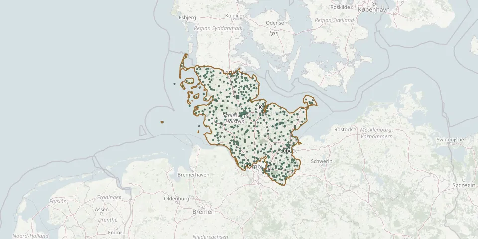 © OpenStreetMap
- Cap Arcona Cemetery of HonourGPS coordinates: 54.05226° N, 10.73680° E
- Cap Arcona Cemetery of HonourGPS coordinates: 54.08898° N, 10.82751° E
- Cemetery of the Homeless, WesterlandGPS coordinates: 54.90577° N, 8.30070° E
- Cemetery of the Nameless, NebelGPS coordinates: 54.64891° N, 8.35384° E
- Cismar CemeteryGPS coordinates: 54.19095° N, 10.98605° E
- Curau CemeteryGPS coordinates: 53.95151° N, 10.61791° E
- Dänischenhagen CemeteryGPS coordinates: 54.42310° N, 10.12649° E
- Dassendorf CemeteryGPS coordinates: 53.49172° N, 10.36269° E
- Deezbüll ChurchyardGPS coordinates: 54.77764° N, 8.81510° E
- Delve CemeteryGPS coordinates: 54.30496° N, 9.25098° E
- Diakonissen CemeteryGPS coordinates: 54.40447° N, 9.51805° E
- Drelsdorf ChurchyardGPS coordinates: 54.60324° N, 9.03629° E
- Eddelak CemeteryGPS coordinates: 53.94786° N, 9.13431° E
- Eichede CemeteryGPS coordinates: 53.71848° N, 10.41559° E
- Eichede ChurchyardGPS coordinates: 53.71732° N, 10.40674° E
- Eichhof Old Urn CemeteryGPS coordinates: 54.33517° N, 10.10664° E
- Einfeld CemeteryGPS coordinates: 54.12823° N, 9.99188° E
- Elmshorn CemeteryGPS coordinates: 53.76116° N, 9.66263° E
- Elmshorn Jewish CemeteryGPS coordinates: 53.75761° N, 9.65422° E
- Elmshorn Municipal CemeteryGPS coordinates: 53.76078° N, 9.69766° E
- Emmaus Church Cemetery, HartenholmGPS coordinates: 53.89394° N, 10.08283° E
- Emmelsbüll CemeteryGPS coordinates: 54.81216° N, 8.68993° E
- Enge-Sande CemeteryGPS coordinates: 54.72846° N, 8.97976° E
- Erfde CemeteryGPS coordinates: 54.30829° N, 9.30672° E
- Esgrus ChurchyardGPS coordinates: 54.72330° N, 9.78062° E
- Eutin Jewish CemeteryGPS coordinates: 54.13201° N, 10.60194° E
- Ev.-Luth. Kirchengemeinde Bad BramstedtGPS coordinates: 53.91837° N, 9.87672° E
- Ewigforst SachsenwaldGPS coordinates: 53.48709° N, 10.33710° E
- Fahretoft CemeteryGPS coordinates: 54.70547° N, 8.79089° E
- Fehmarn Churchyard (Burg)GPS coordinates: 54.43595° N, 11.19520° E