
Alta Verapaz
21 known cemeteries in Alta Verapaz, Guatemala.
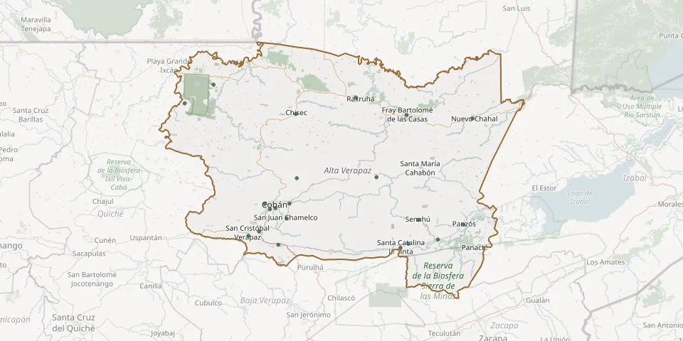 © OpenStreetMap
- Chiquixjí General CemeteryGPS coordinates: 15.56821° N, 90.28875° W
- Chisec General CemeteryGPS coordinates: 15.80699° N, 90.29209° W
- Cobán Municipal CemeteryGPS coordinates: 15.45684° N, 90.37076° W
- Cobán Municipal Cemetery, Alta VerapazGPS coordinates: 15.45241° N, 90.39176° W
- Fray Bartolomé de las Casas Municipal CemeteryGPS coordinates: 15.80357° N, 89.86442° W
- Lanquín General CemeteryGPS coordinates: 15.57172° N, 89.98112° W
- Nuevo Chahal General CemeteryGPS coordinates: 15.79042° N, 89.61025° W
- Panzós Municipal CemeteryGPS coordinates: 15.39578° N, 89.64437° W
- Raxruhá CemeteryGPS coordinates: 15.86845° N, 90.06054° W
- Río Tzetoc CemeteryGPS coordinates: 15.91637° N, 90.61011° W
- Sacsuhá General CemeteryGPS coordinates: 15.32392° N, 89.85837° W
- Salacuim Village General CemeteryGPS coordinates: 15.84647° N, 90.72146° W
- San Cristóbal Verapaz Municipal CemeteryGPS coordinates: 15.35365° N, 90.47484° W
- San Juan Chamelco CemeteryGPS coordinates: 15.41839° N, 90.32767° W
- San Pedro Carchá General CemeteryGPS coordinates: 15.47400° N, 90.31667° W
- Santa Anita CemeteryGPS coordinates: 15.47345° N, 90.41110° W
- Santa Catalina la Tinta Municipal CemeteryGPS coordinates: 15.30884° N, 89.88789° W
- Santa Cruz Verapaz CemeteryGPS coordinates: 15.37011° N, 90.43357° W
- Senahú General CemeteryGPS coordinates: 15.41327° N, 89.81920° W
- Tactic Municipal CemeteryGPS coordinates: 15.31997° N, 90.35939° W
- Telemán General CemeteryGPS coordinates: 15.33958° N, 89.74372° W